

First-time buyer programs
MassHousing sets its own income and price limits for Franklin County. We check them with you before you shop.
MassHousing home loans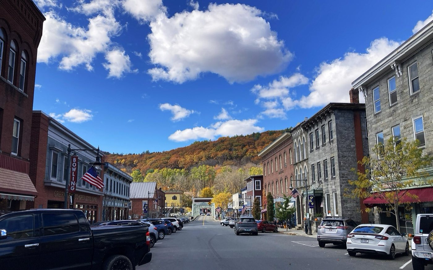
Shelburne is a Franklin County town along the Mohawk Trail (Route 2), on the Deerfield River. Its village of Shelburne Falls, shared with neighboring Buckland, is the town's commercial and cultural center, known for the Bridge of Flowers and the Glacial Potholes carved into the riverbed. Settled in 1756 as "Deerfield Northwest," the town was organized as a district in 1768 and incorporated in 1775, taking its name from William Petty, 2nd Earl of Shelburne.
Shelburne Falls, shared with Buckland, uses ZIP code 01370.
| Area | Zip code | Where it is |
|---|---|---|
| Shelburne Falls | 01370 | A village straddling the Deerfield River between Shelburne and Buckland, with the town's shops, restaurants, library and the Bridge of Flowers. |
Start with Bridge of Flowers and Glacial Potholes, then 2 more below.
A former trolley bridge over the Deerfield River, replanted as a flower garden walkway that is maintained and open to walk across for most of the year.
Water St, Shelburne Falls, MA
A series of smooth rock potholes carved into the riverbed by the Deerfield River over thousands of years, visible along the river below the falls.
Deerfield Ave, Shelburne Falls, MA
A museum and restored trolley line operated on part of the former Shelburne Falls and Colrain Street Railway.
14 Depot St, Shelburne Falls, MA
A historic hall in the Shelburne Falls Historic District used for community and cultural events.
Shelburne Falls, MA
The area was settled in 1756 as "Deerfield Northwest," organized as a district in 1768, and incorporated as the town of Shelburne in 1775, named for William Petty, 2nd Earl of Shelburne.
Silas Lamson patented a curved scythe handle in 1834 and co-founded the Lamson & Goodnow cutlery company in 1837 in Shelburne Falls, which employed more than 500 workers by the Civil War era.
Shelburne Falls' 26-acre historic district includes the village commercial center, Memorial Hall and the Odd Fellows' Hall.
The Deerfield River runs along Shelburne's southern and western border, with Massaemett Mountain giving the town its high point.
1 places in Shelburne to try, including cutlery and kitchenware store. No one paid to be listed.
Cutlery and kitchenware store
A retail outlet for the Lamson & Goodnow cutlery company, which has manufactured knives in Shelburne Falls since 1837.
Shelburne Falls, MA
Shelburne Falls village has a compact, walkable commercial center along Bridge and State streets with the Bridge of Flowers as a pedestrian crossing, but the rest of the town along Route 2 is rural and requires a car.
Approximate, without traffic.
The Franklin Regional Transit Authority (FRTA) runs bus service through the area; the nearest Amtrak station is in Greenfield, about 10 minutes away.
Shelburne's FY2026 residential tax rate is $12.79 per $1,000 of assessed value. Massachusetts assesses homes at full value, so each $100,000 of assessed value costs about $1,279 a year. The average single-family tax bill was $5,146, on an average assessed value of $402,361.
$12.79per $1,000, residential
Source: Massachusetts Division of Local Services, Tax Rates by Class and Average Single Family Tax Bill.
| Fiscal year | Residential rate |
|---|---|
| FY2022 | $14.49 |
| FY2023 | $13.65 |
| FY2024 | $13.26 |
| FY2025 | $12.84 |
| FY2026 | $12.79 |
What we check on a Shelburne purchase: MassHousing limits, the flood map, the smoke certificate, shared village.
MassHousing sets its own income and price limits for Franklin County. We check them with you before you shop.
MassHousing home loansThe Deerfield River runs along Shelburne's southern and western border, and low-lying parcels in Shelburne Falls near the river fall within FEMA-mapped flood zones. We check FEMA's map before you offer.
FEMA's flood map for ShelburneMassachusetts requires the seller to get a smoke and carbon monoxide certificate from the Shelburne Falls Fire District / Shelburne Fire Department before the sale closes.
Shelburne Falls straddles the Shelburne/Buckland town line, so which side of the village a property sits on determines which town's assessor, schools and permitting apply. Buyers should confirm which town a specific address is in before making an offer.
All loans are subject to credit approval, underwriting, and property and program requirements. MassHousing limits and eligibility are set by MassHousing and change from time to time.

We're licensed in Massachusetts. Send us a Shelburne address and we'll run the numbers, taxes included.
Who to call in Shelburne: Eversource for power.
Shelburne's FY2026 residential tax rate is $12.79 per $1,000 of assessed value. Massachusetts fiscal years run July 1 to June 30.
Massachusetts taxes homes on their full assessed value. If a home is assessed at $400,000, that's about $5,116 a year at $12.79 per $1,000. The bill uses the assessor's value, not the sale price.
No. Shelburne uses a single rate of $12.79 per $1,000 for all property classes.
The average single-family tax bill in Shelburne was $5,146 for FY2026, on an average assessed value of $402,361.
Shelburne is in Franklin County.
Shelburne Falls, shared with Buckland, uses ZIP code 01370.
Shelburne is about 5 miles from Greenfield, roughly a 10 minute drive.
Shelburne borders Colrain, Greenfield, Deerfield, Conway, Buckland and a short stretch of Charlemont.
Shelburne Falls is a village that straddles both towns, connected by the Bridge of Flowers over the Deerfield River.
Neighbors of Shelburne, including across the Connecticut line where it applies. All Massachusetts town guides.