

Warwick center
12 Athol Rd, Warwick, MA 01378
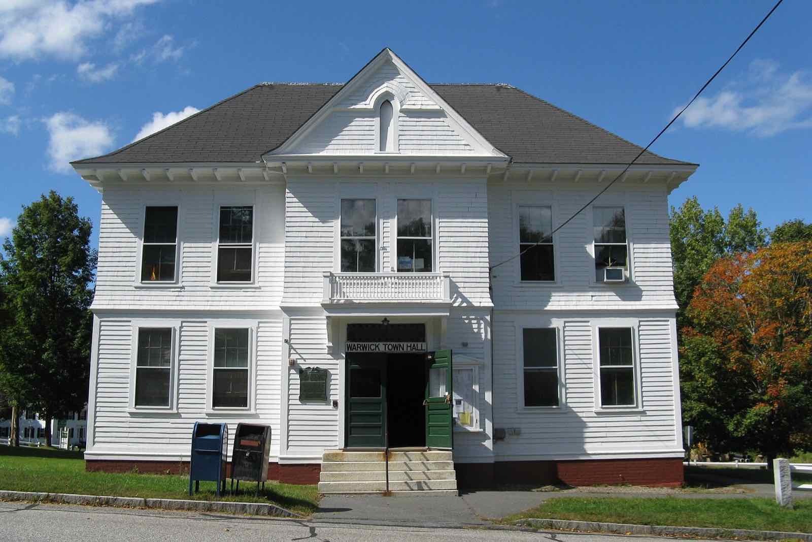
Warwick is a hill town in the northeast corner of Franklin County, on the New Hampshire line, incorporated in 1763. Mount Grace, at 1,617 feet, rises in the center of town, and roughly a third of Warwick's land is protected as Warwick State Forest or Mount Grace State Forest. Route 78 is the only state highway through town.
Warwick uses a single ZIP code, 01378, for the whole town.
| Area | Zip code | Where it is |
|---|---|---|
| Warwick center | 01378 | Around the town common on Athol Road (Route 78), where Town Hall, the library and the church are located. |
Start with Mount Grace State Forest and Warwick State Forest, then 1 more below.
A state forest centered on 1,617-foot Mount Grace, the high point of the surrounding hills. The Metacomet-Monadnock Trail crosses the summit, and a fire tower and trails give views over the Millers River valley.
Off Route 78, Warwick, MA
A large block of state forest land covering much of the town's western side, with woods roads used for hiking, mountain biking and hunting.
Off Northfield Road, Warwick, MA
A large glacial boulder engraved in 1916 with the words "In The Beginning God," a local landmark along a woods trail.
Warwick, MA
Warwick was one of four tracts of land Massachusetts set aside in 1735 to compensate officers and soldiers from the 1690 expedition against Quebec; the settlement was first called Gardner's Canada before its 1763 incorporation as Warwick.
The Brotherhood of the Spirit, a commune, operated in Warwick through the 1960s and into the 1970s.
Mount Grace and the surrounding state forest land give Warwick most of its outdoor recreation, from a fire-tower summit to miles of forest roads and trails.
Warwick center, a small cluster of buildings around the town common on Athol Road, can be crossed on foot, but the rest of this rural, low-density town has no sidewalks and is built for driving.
12 Athol Rd, Warwick, MA 01378
Approximate, without traffic.
Warwick has no fixed-route public transit and no train station. The nearest Amtrak service is the Vermonter, which stops in Brattleboro, Vermont.
Warwick's FY2026 residential tax rate is $16.54 per $1,000 of assessed value. Massachusetts assesses homes at full value, so each $100,000 of assessed value costs about $1,654 a year. The average single-family tax bill was $4,795, on an average assessed value of $289,880.
$16.54per $1,000, residential
Source: Massachusetts Division of Local Services, Tax Rates by Class and Average Single Family Tax Bill.
| Fiscal year | Residential rate |
|---|---|
| FY2022 | $21.07 |
| FY2023 | $20.11 |
| FY2024 | $16.55 |
| FY2025 | $17.78 |
| FY2026 | $16.54 |
What we check on a Warwick purchase: MassHousing limits, the flood map, the smoke certificate, well & septic, rural / forest land.
MassHousing sets its own income and price limits for Franklin County. We check them with you before you shop.
MassHousing home loansFlood zones are set address by address. We check FEMA's map before you offer.
FEMA's flood map for WarwickMassachusetts requires the seller to get a smoke and carbon monoxide certificate from the Warwick Fire Department before the sale closes.
Warwick has no public water or sewer system, so every home relies on a private well and septic system. Massachusetts requires a Title 5 septic inspection before a home on septic can be sold, and we build that timeline into your preapproval.
Roughly a third of Warwick is Mount Grace or Warwick State Forest land, which shapes where building lots exist and how a property borders public land. Confirm lot lines and any forest-abutting restrictions before you make an offer.
All loans are subject to credit approval, underwriting, and property and program requirements. MassHousing limits and eligibility are set by MassHousing and change from time to time.

We're licensed in Massachusetts. Send us a Warwick address and we'll run the numbers, taxes included.
Who to call in Warwick: National Grid for power.
Saturdays 8am-3pm year-round; Wednesdays 3-6pm, April through September
No vehicle sticker; bagged trash by the bag or roll (33-gallon bags around $3 each by the roll of 10, 15-gallon bags around $1.50 each by the roll of 10), bulky items $50-$90 per cubic yard
Transfer station detailsWarwick Town Hall is at 12 Athol Rd, Warwick, MA 01378. Hours: By department; Town Clerk Tues 10am-12pm, Wed 10am-1pm. Main line: 978-544-6315.
Warwick's FY2026 residential tax rate is $16.54 per $1,000 of assessed value. Massachusetts fiscal years run July 1 to June 30.
Massachusetts taxes homes on their full assessed value. If a home is assessed at $400,000, that's about $6,616 a year at $16.54 per $1,000. The bill uses the assessor's value, not the sale price.
No. Warwick uses a single rate of $16.54 per $1,000 for all property classes.
The average single-family tax bill in Warwick was $4,795 for FY2026, on an average assessed value of $289,880.
Warwick is in Franklin County, Massachusetts.
Warwick uses a single ZIP code, 01378, for the whole town.
No. Residents bring trash and recycling to the town transfer station, open Saturdays year-round and Wednesday afternoons in warmer months, and pay per bag rather than by an annual sticker.
National Grid is the electric utility for Warwick.
Warwick is about 20 miles from Greenfield, the Franklin County seat, roughly a 30-35 minute drive.
No. Warwick has no public water or sewer system; homes use private wells and septic systems.
Neighbors of Warwick, including across the Connecticut line where it applies. All Massachusetts town guides.