

Marlborough center
140 Main St, Marlborough, MA 01752
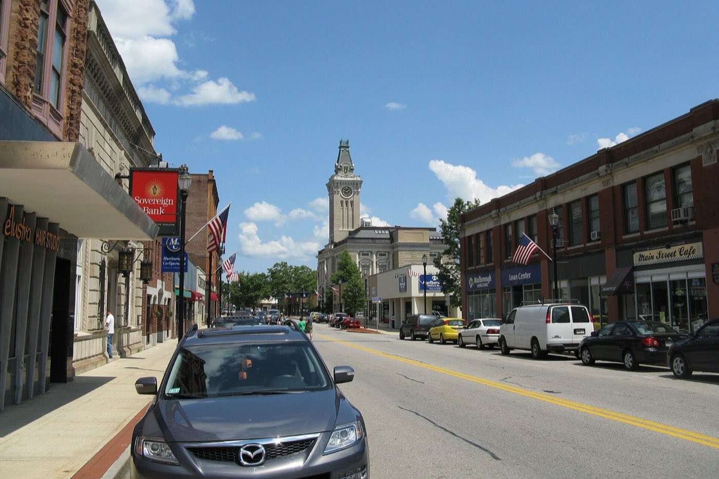
Marlborough is a city in MetroWest, about 30 miles west of Boston, founded by settlers from Sudbury in 1656 and incorporated as a town in 1660, becoming a city in 1890. The Assabet River crosses the northwest corner of the city, and three lakes, Lake Williams, Millham Reservoir and Fort Meadow Reservoir, sit within city limits. By 1890, Marlborough had become a major shoe-manufacturing center, producing boots for Union soldiers during the Civil War.
Marlborough uses a single ZIP code, 01752, for the whole city.
| Area | Zip code | Where it is |
|---|---|---|
| Marlborough center | 01752 | Along Main Street, where City Hall, shops and municipal offices are located. |
Start with Assabet River Rail Trail and Capt. Peter Rice House, then 1 more below.
A multi-use trail converted from the former Marlborough Branch railroad corridor, with paved and unpaved sections running through Marlborough, Hudson, Stow, Maynard and Acton along the Assabet River.
Marlborough, MA
A house dating to about 1688, one of the city's oldest surviving structures.
Marlborough, MA
A historic district around the city center with buildings reflecting Marlborough's development as a mill and shoe-manufacturing city.
Main St, Marlborough, MA
Marlborough was founded in 1656 by settlers from Sudbury and incorporated as a town in 1660, taking its name from the market town of Marlborough in Wiltshire, England.
By 1890, when it was incorporated as a city, Marlborough had become a major shoe-manufacturing center, producing boots for Union soldiers during the Civil War.
George Washington visited Williams Tavern in Marlborough shortly after his 1789 inauguration.
Marlborough's outdoor recreation centers on the Assabet River in the city's northwest corner and on Lake Williams, Millham Reservoir and Fort Meadow Reservoir within city limits.
Marlborough's city center along Main Street has sidewalks connecting City Hall and downtown businesses, and the Assabet River Rail Trail gives a car-free route along the river, but most of the city, especially its Route 20 and Route 495 commercial areas, is built for driving.
140 Main St, Marlborough, MA 01752
Approximate, without traffic.
The MetroWest Regional Transit Authority (MWRTA) operates local bus routes in Marlborough, including a Downtown Marlborough Loop. Marlborough has no commuter rail station of its own; the closest MBTA Commuter Rail service is on the Framingham/Worcester Line.
Marlborough's FY2026 residential tax rate is $10.54 per $1,000 of assessed value. Commercial, industrial and personal property pay $18.43. Massachusetts assesses homes at full value, so each $100,000 of assessed value costs about $1,054 a year. The average single-family tax bill was $6,441, on an average assessed value of $611,100.
$10.54per $1,000, residential
Source: Massachusetts Division of Local Services, Tax Rates by Class and Average Single Family Tax Bill.
| Fiscal year | Residential rate |
|---|---|
| FY2022 | $13.12 |
| FY2023 | $11.54 |
| FY2024 | $10.24 |
| FY2025 | $9.86 |
| FY2026 | $10.54 |
What we check on a Marlborough purchase: MassHousing limits, the flood map, the smoke certificate, river flood zone, lake communities.
MassHousing sets its own income and price limits for Middlesex County. We check them with you before you shop.
MassHousing home loansThe Assabet River crosses Marlborough's northwest corner, putting low-lying parcels near the river in FEMA-mapped flood zones. We check FEMA's map before you offer.
FEMA's flood map for MarlboroughMassachusetts requires the seller to get a smoke and carbon monoxide certificate from the Marlborough Fire Department before the sale closes. Call 508-624-6986 to schedule.
Marlborough Fire Department pageParts of northwest Marlborough near the Assabet River fall within FEMA flood zones. We check the flood map before you make an offer on a property near the river.
Marlborough has three lakes within city limits, including Lake Williams and Fort Meadow Reservoir, and homes near them may carry lake or association considerations. Ask about any lake-specific rules before making an offer.
All loans are subject to credit approval, underwriting, and property and program requirements. MassHousing limits and eligibility are set by MassHousing and change from time to time.

We're licensed in Massachusetts. Send us a Marlborough address and we'll run the numbers, taxes included.
Who to call in Marlborough: National Grid for power.
Monday-Friday, 7 AM-3:30 PM (DPW office hours)
Transfer station detailsMarlborough City Hall is at 140 Main St, Marlborough, MA 01752. Main line: 508-460-3770.
Marlborough's FY2026 residential tax rate is $10.54 per $1,000 of assessed value. Commercial, industrial and personal property pay $18.43. Massachusetts fiscal years run July 1 to June 30.
Massachusetts taxes homes on their full assessed value. If a home is assessed at $400,000, that's about $4,216 a year at $10.54 per $1,000. The bill uses the assessor's value, not the sale price.
Yes. Homes pay $10.54 per $1,000 and commercial, industrial and personal property pay $18.43.
The average single-family tax bill in Marlborough was $6,441 for FY2026, on an average assessed value of $611,100.
Marlborough is in Middlesex County.
Marlborough uses a single ZIP code, 01752, for the whole city.
No. Marlborough has no commuter rail station of its own; the closest MBTA service is on the Framingham/Worcester Line.
Yes. The MetroWest Regional Transit Authority (MWRTA) operates local routes, including a Downtown Marlborough Loop.
National Grid.
Marlborough borders Berlin, Hudson, Sudbury, Framingham, Southborough and Northborough.
Neighbors of Marlborough, including across the Connecticut line where it applies. All Massachusetts town guides.