

Downtown / City Hall area
455 Main St, Worcester, MA 01608
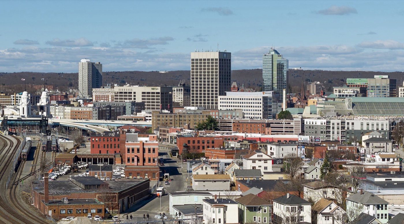
Worcester is the county seat of Worcester County and the second-largest city in Massachusetts, about 40 miles west of Boston. It was settled in 1673, resettled permanently in 1713, and incorporated as a town in 1722 before becoming a city in 1848. The Blackstone River runs through the center of the city, and the Blackstone Canal and the arrival of the railroad in the 1800s built Worcester into a manufacturing center for textiles, wire and machinery.
Worcester uses multiple ZIP codes by neighborhood, generally in the 01601-01610 and 01613-01615 range, plus separate codes for PO boxes.
| Area | Zip code | Where it is |
|---|---|---|
| Downtown / City Hall area | 01608 | Along Main Street, where City Hall, Mechanics Hall and Worcester Common are located. |
| Shrewsbury Street | 01604 | A commercial corridor on the city's east side known locally as Restaurant Row, running from Kelley Square toward Shrewsbury. |
| Main South | 01610 | The area around Main Street south of downtown, near Clark University. |
| Quinsigamond Village | 01604 | A neighborhood on the city's south side along the Blackstone River. |
Start with Worcester Art Museum and Elm Park, then 3 more below.
An encyclopedic art museum with collections spanning ancient to contemporary work, including arms and armor and a reassembled medieval chapter house.
55 Salisbury St, Worcester, MA
A city park designed in part by Frederick Law Olmsted, first improved in 1854, with ponds, footbridges and walking paths.
Park Ave, Worcester, MA
A roughly 549-acre municipal park with trails, sports fields, a public golf course and views over the city.
Skyline Dr, Worcester, MA
A restored early-20th-century theater in downtown Worcester hosting touring Broadway shows, concerts and comedy.
2 Southbridge St, Worcester, MA
An 1857 concert hall in downtown Worcester still used for classical, folk and popular performances.
321 Main St, Worcester, MA
Worcester was first settled by colonists in 1673, abandoned during conflict, and permanently resettled in 1713 by Jonas Rice; it was incorporated as a town in 1722 and chartered as a city in 1848.
The Blackstone Canal opened through Worcester in 1828 and the railroad arrived in 1835, turning the town into a manufacturing center for textiles, wire, machinery and shoes through the 19th and early 20th centuries.
The Boulevard Diner on Shrewsbury Street, built in 1936 by the Worcester Lunch Car Company, is listed on the National Register of Historic Places as one of the city's best-preserved 1930s diners.
Worcester's park system includes Olmsted-designed Elm Park and the larger Green Hill Park, along with Lake Quinsigamond on the city's eastern edge.
3 places in Worcester to try, including diner and seafood restaurant. No one paid to be listed.
Diner
A 1936 barrel-roof diner built by the Worcester Lunch Car Company, listed on the National Register of Historic Places, serving breakfast and diner fare on Shrewsbury Street.
155 Shrewsbury St, Worcester, MA 01604
Seafood restaurant
A seafood restaurant open since 1979 near Clark University, serving raw bar, sushi and fresh fish.
118 Highland St, Worcester, MA 01609 · thesole.com
Steakhouse
A steakhouse on Shrewsbury Street that has operated for more than two decades.
111 Shrewsbury St, Worcester, MA 01604 · 111chophouse.com
Downtown Worcester and neighborhoods like Shrewsbury Street and Main South have sidewalks and a denser street grid for walking between shops and restaurants, but most of the city's residential neighborhoods and its outlying parks are built around driving.
455 Main St, Worcester, MA 01608
Approximate, without traffic.
The Worcester Regional Transit Authority (WRTA) operates local bus routes throughout the city and has been fare-free since March 2020. Union Station downtown is the western terminus of the MBTA Commuter Rail Framingham/Worcester Line to Boston South Station, and is also served by Amtrak's Lake Shore Limited, plus Peter Pan and Greyhound intercity buses.
Worcester's FY2026 residential tax rate is $13.28 per $1,000 of assessed value. Commercial, industrial and personal property pay $29.06. Massachusetts assesses homes at full value, so each $100,000 of assessed value costs about $1,328 a year. The average single-family tax bill was $5,446, on an average assessed value of $410,086.
$13.28per $1,000, residential
Source: Massachusetts Division of Local Services, Tax Rates by Class and Average Single Family Tax Bill.
| Fiscal year | Residential rate |
|---|---|
| FY2022 | $15.21 |
| FY2023 | $14.34 |
| FY2024 | $13.75 |
| FY2025 | $13.19 |
| FY2026 | $13.28 |
What we check on a Worcester purchase: MassHousing limits, the flood map, the smoke certificate, older housing stock, river flood zone.
MassHousing sets its own income and price limits for Worcester County. We check them with you before you shop.
MassHousing home loansThe Blackstone River runs through the center of Worcester, and Mill Brook and other tributaries put some low-lying parcels near the river and its brooks in FEMA-mapped flood zones. We check FEMA's map before you offer.
FEMA's flood map for WorcesterMassachusetts requires the seller to get a smoke and carbon monoxide certificate from the Worcester Fire Department before the sale closes. Call 508-799-1821 to schedule.
Worcester Fire Department pageMassachusetts requires a smoke detector and carbon monoxide detector compliance certificate from the local fire department before a home sale closes. Worcester's Fire Department handles these inspections for the city's largely older, multi-family and single-family housing stock.
Parts of Worcester near the Blackstone River and its brooks fall within FEMA flood zones. We check the flood map before you make an offer on a property near the water.
All loans are subject to credit approval, underwriting, and property and program requirements. MassHousing limits and eligibility are set by MassHousing and change from time to time.

We're licensed in Massachusetts. Send us a Worcester address and we'll run the numbers, taxes included.
Who to call in Worcester: National Grid (Massachusetts Electric Company) for power.
20 East Worcester Street, Worcester, MA 01604 Monday-Friday, 9 a.m.-4 p.m.
Worcester City Hall is at 455 Main St, Worcester, MA 01608. Hours: Monday 8:45 a.m.-5 p.m.; Tuesday-Friday 8:45 a.m.-4:15 p.m.. Main line: 508-799-1121.
Worcester's FY2026 residential tax rate is $13.28 per $1,000 of assessed value. Commercial, industrial and personal property pay $29.06. Massachusetts fiscal years run July 1 to June 30.
Massachusetts taxes homes on their full assessed value. If a home is assessed at $400,000, that's about $5,312 a year at $13.28 per $1,000. The bill uses the assessor's value, not the sale price.
Yes. Homes pay $13.28 per $1,000 and commercial, industrial and personal property pay $29.06.
The average single-family tax bill in Worcester was $5,446 for FY2026, on an average assessed value of $410,086.
Worcester is the county seat of Worcester County.
Yes. The Worcester Regional Transit Authority has offered fare-free bus service since March 2020.
Union Station downtown is the western terminus of the MBTA Commuter Rail Framingham/Worcester Line to Boston, and is also served by Amtrak's Lake Shore Limited.
National Grid (Massachusetts Electric Company) delivers electricity in Worcester.
Yes. Worcester uses a pay-as-you-throw yellow bag program with curbside collection, plus a Residential Drop-Off Center for bulk and yard waste.
Worcester is about 40 miles west of Boston, roughly a 60-75 minute drive depending on traffic.
Neighbors of Worcester, including across the Connecticut line where it applies. All Massachusetts town guides.