

Townsend center
272 Main Street, Townsend, MA 01469
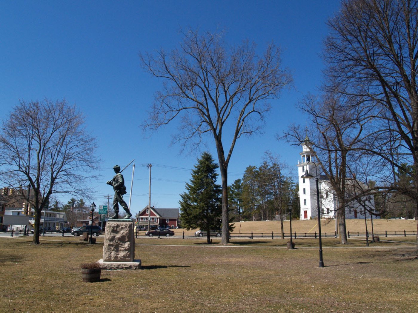
Townsend is a town in Middlesex County on the New Hampshire line, incorporated in 1732 on land settled in 1676. It has the largest land area of any town in Middlesex County, and the Squannacook River rises in its western hills. The town is split between two ZIP codes, Townsend center (01469) and West Townsend (01474).
Townsend uses two ZIP codes: 01469 for Townsend center and 01474 for West Townsend.
| Area | Zip code | Where it is |
|---|---|---|
| Townsend center | 01469 | The town's main village along Main Street, with Town Hall and the historic common. |
| West Townsend | 01474 | A village in the western part of town, near the Ashby line. |
Start with Townsend Common and Reed Homestead, then 1 more below.
The town's historic common in the center village, surrounded by Town Hall and the United Methodist Church, built in 1770.
Main Street, Townsend, MA
A historic homestead with murals attributed to Rufus Porter, who went on to found Scientific American.
Townsend, MA
The Squannacook River rises in Townsend's western hills, offering fishing and paddling access as it flows toward Groton and Shirley.
Western Townsend, MA
The area's Indigenous name was Wistequassuck before European settlement began in 1676.
The town was incorporated in 1732 and named after Charles Townshend, an English secretary of state; the town dropped the "h" from its spelling in response to the unpopular Townshend Acts of 1767.
The Reed Homestead contains murals attributed to Rufus Porter, an itinerant artist who later founded Scientific American magazine.
Townsend's outdoor recreation centers on the Squannacook River, which rises in the town's western hills, and on its rural hill terrain near the New Hampshire line.
Townsend center has sidewalks around the common, Town Hall, and Main Street businesses, but West Townsend and the town's rural outlying areas are built around driving.
272 Main Street, Townsend, MA 01469
Approximate, without traffic.
Townsend has no MBTA commuter rail station; Massachusetts Route 119 runs east-west and Route 13 runs north-south through town. The Montachusett Regional Transit Authority (MART) serves the area.
Townsend's FY2026 residential tax rate is $13.75 per $1,000 of assessed value. Massachusetts assesses homes at full value, so each $100,000 of assessed value costs about $1,375 a year. The average single-family tax bill was $6,459, on an average assessed value of $469,723.
$13.75per $1,000, residential
Source: Massachusetts Division of Local Services, Tax Rates by Class and Average Single Family Tax Bill.
| Fiscal year | Residential rate |
|---|---|
| FY2022 | $17.61 |
| FY2023 | $15.26 |
| FY2024 | $14.41 |
| FY2025 | $14.52 |
| FY2026 | $13.75 |
What we check on a Townsend purchase: MassHousing limits, the flood map, the smoke certificate, septic & wells, smoke & co certificate.
MassHousing sets its own income and price limits for Middlesex County. We check them with you before you shop.
MassHousing home loansThe Squannacook River, which rises in Townsend's western hills, puts some low-lying parcels along it in FEMA-mapped flood zones. We check FEMA's map before you offer.
FEMA's flood map for TownsendMassachusetts requires the seller to get a smoke and carbon monoxide certificate from the Townsend Fire Department before the sale closes.
Townsend's Health Department handles septic and well permits, with some functions handled through the regional Nashoba Associated Boards of Health, based in Ayer. Homes on septic need a Title 5 inspection before sale.
Sellers need a smoke detector and carbon monoxide alarm compliance certificate from the local fire department before closing. Townsend's Fire/EMS Department, at 13 Elm Street, handles these inspections.
All loans are subject to credit approval, underwriting, and property and program requirements. MassHousing limits and eligibility are set by MassHousing and change from time to time.

We're licensed in Massachusetts. Send us a Townsend address and we'll run the numbers, taxes included.
Who to call in Townsend: Unitil (distribution); the town also runs a Community Electricity Aggregation program for supply for power.
27 Greenville Road, Townsend, MA 01469 1st and 3rd Saturday of the month, 7am-2pm
Townsend Town Hall is at 272 Main Street, Townsend, MA 01469. Main line: 978-597-1700.
Townsend's FY2026 residential tax rate is $13.75 per $1,000 of assessed value. Massachusetts fiscal years run July 1 to June 30.
Massachusetts taxes homes on their full assessed value. If a home is assessed at $400,000, that's about $5,500 a year at $13.75 per $1,000. The bill uses the assessor's value, not the sale price.
No. Townsend uses a single rate of $13.75 per $1,000 for all property classes.
The average single-family tax bill in Townsend was $6,459 for FY2026, on an average assessed value of $469,723.
Townsend does not offer curbside collection. Residents bring trash and recycling to the town's Recycling Center on Greenville Road, open the 1st and 3rd Saturday of each month, 7am to 2pm.
Unitil owns the distribution poles and wires serving Townsend; the town also runs a Community Electricity Aggregation program that can affect the supply price.
Townsend center uses 01469, and West Townsend uses its own ZIP code, 01474.
No. Townsend has no MBTA commuter rail station; the Montachusett Regional Transit Authority (MART) provides local transit.
Townsend's Health Department issues septic and well permits, with some functions handled through the regional Nashoba Associated Boards of Health in Ayer.
Townsend is about 14 miles from Fitchburg, roughly a 20-25 minute drive.
Neighbors of Townsend, including across the Connecticut line where it applies. All Massachusetts town guides.