

Randolph center
41 South Main St, Randolph, MA 02368
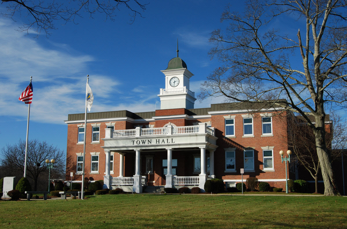
Randolph is a South Shore city drained by the Cochato River and Blue Hill River, which feed the Neponset River, with the Blue Hills Reservation reaching into its northern edge. It was incorporated as a town in 1793, set off from Braintree, and adopted a city charter in 2010 while keeping its historic Town Hall. Interstate 93 and Route 24 both pass through Randolph, making it a highway crossroads on the South Shore.
Randolph uses a single ZIP code, 02368, for the whole city.
| Area | Zip code | Where it is |
|---|---|---|
| Randolph center | 02368 | The area around Town Hall on South Main Street. |
Start with Ponkapoag Camp / Blue Hills Reservation and Turner Free Library, then 1 more below.
A section of the Blue Hills Reservation reaching into northern Randolph, including the historic Ponkapoag Camp of the Appalachian Mountain Club, with trails, a golf course and Ponkapoag Pond.
Randolph/Canton/Milton, MA
Randolph's public library, established in 1875.
Randolph, MA
An 1806 historic house associated with early Randolph history.
Randolph, MA
Randolph was set off from Braintree and incorporated as a town in 1793, named for Peyton Randolph, the first president of the Continental Congress.
By 1850, Randolph had become one of the nation's leading boot manufacturing centers, shipping boots as far as California and Australia.
The idea for the Great American Smokeout anti-smoking campaign traces to a 1969 suggestion by a Randolph High School guidance counselor.
Randolph adopted a city charter in 2010 after more than two centuries as a town.
Randolph's share of the Blue Hills Reservation, including Ponkapoag Pond, gives the city trail and pond access along its northern border.
Randolph center along South Main Street has some walkable commercial areas, but most of the city, laid out around Route 28 and Route 139, is built for driving.
41 South Main St, Randolph, MA 02368
Approximate, without traffic.
The Holbrook/Randolph MBTA Commuter Rail station, on the Fall River/New Bedford Line, serves the city. MBTA and Brockton Area Transit Authority (BAT) buses also run through Randolph, and the city sits at the junction of Interstate 93, U.S. Route 1, and Massachusetts Routes 24, 28 and 139.
Randolph's FY2026 residential tax rate is $11.58 per $1,000 of assessed value. Commercial, industrial and personal property pay $22.11. Massachusetts assesses homes at full value, so each $100,000 of assessed value costs about $1,158 a year. The average single-family tax bill was $6,328, on an average assessed value of $546,462.
$11.58per $1,000, residential
Source: Massachusetts Division of Local Services, Tax Rates by Class and Average Single Family Tax Bill.
| Fiscal year | Residential rate |
|---|---|
| FY2022 | $13.60 |
| FY2023 | $12.08 |
| FY2024 | $11.45 |
| FY2025 | $11.61 |
| FY2026 | $11.58 |
What we check on a Randolph purchase: MassHousing limits, the flood map, the smoke certificate, river flood zone, smoke/co certificate.
MassHousing sets its own income and price limits for Norfolk County. We check them with you before you shop.
MassHousing home loansThe Cochato River and Blue Hill River, which drain into the Neponset River, run through Randolph, putting low-lying parcels along them within FEMA-mapped flood zones. We check FEMA's map before you offer.
FEMA's flood map for RandolphMassachusetts requires the seller to get a smoke and carbon monoxide certificate from the Randolph Fire Department before the sale closes.
Randolph Fire Department pageParts of Randolph along the Cochato River and Blue Hill River fall within FEMA flood zones. We check the flood map before you make an offer near either river.
Massachusetts law requires a smoke and carbon monoxide detector compliance certificate from the local fire department before a home sale can close.
All loans are subject to credit approval, underwriting, and property and program requirements. MassHousing limits and eligibility are set by MassHousing and change from time to time.

We're licensed in Massachusetts. Send us a Randolph address and we'll run the numbers, taxes included.
Who to call in Randolph.
Randolph Town Hall is at 41 South Main St, Randolph, MA 02368. Main line: 781-961-0900.
Randolph's FY2026 residential tax rate is $11.58 per $1,000 of assessed value. Commercial, industrial and personal property pay $22.11. Massachusetts fiscal years run July 1 to June 30.
Massachusetts taxes homes on their full assessed value. If a home is assessed at $400,000, that's about $4,632 a year at $11.58 per $1,000. The bill uses the assessor's value, not the sale price.
Yes. Homes pay $11.58 per $1,000 and commercial, industrial and personal property pay $22.11.
The average single-family tax bill in Randolph was $6,328 for FY2026, on an average assessed value of $546,462.
Randolph is in Norfolk County.
Randolph adopted a city charter in 2010 after more than two centuries as a town; its municipal building is still called Town Hall.
Randolph uses a single ZIP code, 02368, for the whole city.
Yes. The city provides curbside trash and recycling collection along with a yard-waste program and drop-off center.
The Holbrook/Randolph station on the Fall River/New Bedford Line serves the area.
Randolph borders Quincy, Braintree, Holbrook, Avon, Stoughton, Canton and Milton.
Neighbors of Randolph, including across the Connecticut line where it applies. All Massachusetts town guides.