

First-time buyer programs
MassHousing sets its own income and price limits for Suffolk County. We check them with you before you shop.
MassHousing home loans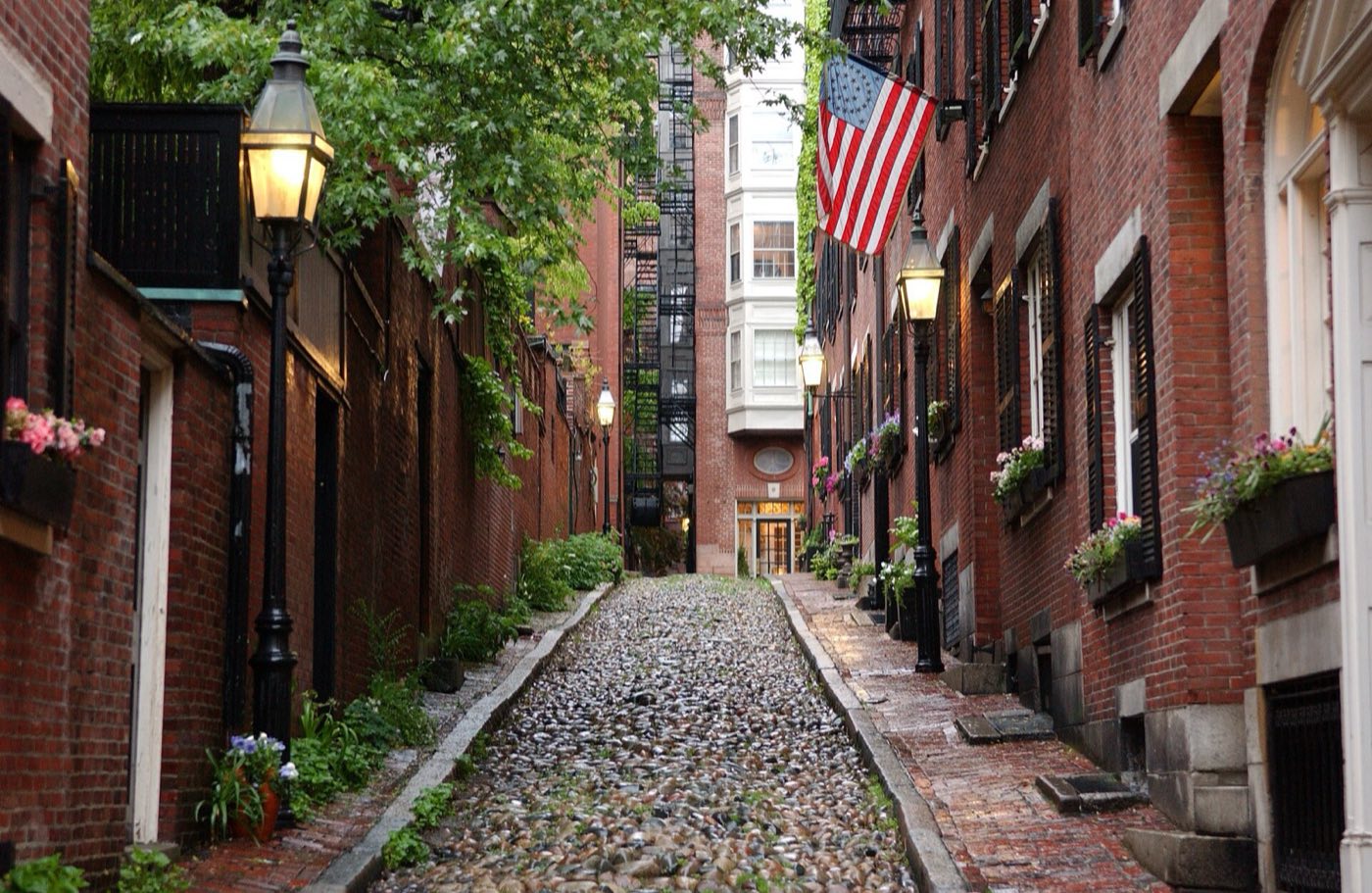
Boston is the capital of Massachusetts and the largest city in New England, built on a peninsula between the Charles River and Boston Harbor. It was settled by Puritan colonists in 1630 and incorporated as a city in 1822; land-filling projects between the 17th and late 19th centuries, including the filling of the Back Bay, more than tripled its original area. The city is organized into about two dozen distinct neighborhoods, each with its own commercial center, rather than a single downtown surrounded by suburbs.
Boston uses dozens of ZIP codes, generally one or more per neighborhood rather than one for the whole city.
| Area | Zip code | Where it is |
|---|---|---|
| Downtown / Financial District | 02108, 02109, 02110, 02111 | Boston's downtown core, including the Financial District, Government Center and Downtown Crossing; Boston City Hall is at 1 City Hall Square. |
| Back Bay | 02116 | A neighborhood of Victorian brownstones on land reclaimed from the Charles River basin, west of Boston Common along Commonwealth Avenue. |
| Beacon Hill | 02108 | A historic district of Federal-style rowhouses, narrow streets and brick sidewalks just north of Boston Common, home to the Massachusetts State House. |
| North End | 02113 | Boston's oldest residential neighborhood, on the Shawmut Peninsula near the harbor, known for its Italian restaurants and bakeries and for Old North Church. |
| West End | 02114 | A neighborhood of high-rise residential towers near North Station and Massachusetts General Hospital. |
| Chinatown | 02111 | A downtown district anchored by Asian restaurants, groceries and cultural institutions, near the Theater District. |
| South End | 02118 | A Victorian rowhouse district bordered by Back Bay, Chinatown and Roxbury; it holds the largest intact Victorian rowhouse district in the country. |
| South Boston | 02127 | A peninsula south and east of the Fort Point Channel, including the Seaport District's newer waterfront development; ZIP 02210 covers part of the Seaport. |
| East Boston | 02128 | A peninsula across Boston Harbor from downtown, reached by tunnel; Logan International Airport occupies much of its eastern side. |
| Charlestown | 02129 | A peninsula north of the Charles River and the oldest settlement in modern Boston, home to the Bunker Hill Monument and the Charlestown Navy Yard, where the USS Constitution is docked. |
| Fenway-Kenmore | 02115, 02215 | The neighborhood around Fenway Park, between Back Bay and Brookline. |
| Dorchester | 02122, 02124, 02125 | Boston's largest neighborhood by area, more than 6 square miles, annexed from the former town of Dorchester in 1870. |
| Roxbury | 02119, 02120, 02121 | One of the Massachusetts Bay Colony's original 1630 towns, annexed to Boston in 1868. |
| Jamaica Plain | 02130 | A former streetcar suburb built up in the 19th century, home to the Arnold Arboretum and Jamaica Pond, both part of the Emerald Necklace. |
| Allston | 02134 | A neighborhood along the Charles River bordering Cambridge, Brighton and the Fenway. |
| Brighton | 02135 | A former town in Boston's northwest corner, now home to Boston College's campus and New Balance's headquarters. |
| Hyde Park | 02136 | Boston's southernmost neighborhood, about 8 miles from downtown along the Neponset River valley, bordering Dedham and Milton. |
| Mattapan | 02126 | A neighborhood bounded by the Neponset River, with Blue Hill Avenue and Mattapan Square as its commercial center. |
| Roslindale | 02131 | A largely residential neighborhood about 6 miles south-southwest of downtown, centered on Roslindale Square; the Arnold Arboretum's southern edge extends into the area. |
| West Roxbury | 02132 | A residential neighborhood in Boston's southwest corner bordering Newton, Dedham and Needham, with Stony Brook Reservation and the VFW Parkway running through it. |
Start with The Freedom Trail and Boston Common and Public Garden, then 4 more below.
A 2.5-mile, red-brick-marked walking route linking 16 historic sites, from Boston Common to the Charlestown Navy Yard. Walking it is free; the Freedom Trail Foundation also runs paid guided tours in period costume.
Starts at Boston Common, 139 Tremont St
Plan a visitBoston Common, established in 1634, is the oldest park in the country and includes the Frog Pond for winter skating. It adjoins the Public Garden, a formal Victorian garden with the Swan Boats.
139 Tremont St, Boston, MA 02111
Plan a visitA historic market complex built in 1824-1826 and designed by architect Alexander Parris, now a festival marketplace with more than 80 shops, restaurants and food stalls. It sits on the Freedom Trail near the State, Haymarket and Government Center MBTA stations.
4 S Market St, Boston, MA 02109
Plan a visitA waterfront aquarium built around a multi-story Giant Ocean Tank, with exhibits on penguins, harbor seals and an Amazon rainforest habitat.
1 Central Wharf, Boston, MA 02110
Plan a visitOne of the largest museums in the country, with collections spanning Egyptian, Greek and Roman antiquities, Asian and European art, and American art and photography.
465 Huntington Ave, Boston, MA 02115
Plan a visitA former U.S. Navy shipyard on the Freedom Trail where the USS Constitution, the world's oldest commissioned warship still afloat, is docked and open for tours.
Charlestown Navy Yard, Boston, MA 02129
Plan a visitBoston was founded by Puritan colonists in 1630 on the Shawmut Peninsula and incorporated as a city in 1822.
The city was the site of the Boston Tea Party in 1773 and the Siege of Boston in 1775-1776 during the American Revolution.
Extensive land-filling between the 17th century and 1890, including the filling of the Back Bay with gravel carried by rail from Needham, more than tripled the city's original land area.
Boston's park system, much of it designed by Frederick Law Olmsted, runs from the harbor to the edge of Roxbury and Jamaica Plain.
4 places in Boston to try, including seafood restaurant and italian bakery. No one paid to be listed.
Seafood restaurant
Opened in 1826 in a building dating to about 1716, and recognized as a National Historic Landmark; it is described as the oldest restaurant in continuous service in the United States.
41-43 Union St, Boston, MA 02108 · unionoysterhouse.com
Italian bakery
A North End bakery founded in 1946, known for its cannoli.
300 Hanover St, Boston, MA 02113 · mikespastry.com
Pizzeria
Boston's oldest pizzeria, open in the North End since 1926, making its dough and sausage daily; TripAdvisor named it the top pizza restaurant in the U.S. in 2018.
11 1/2 Thacher St, Boston, MA 02113
Food hall
The central building of Faneuil Hall Marketplace, built in 1824-1826, now holds more than 25 food vendors selling seafood and other Boston specialties.
4 S Market St, Boston, MA 02109 · faneuilhallmarketplace.com
Boston's older neighborhoods, including Back Bay, Beacon Hill, the North End and downtown, are dense and highly walkable with extensive sidewalks and subway access. Outlying neighborhoods such as Hyde Park, West Roxbury and Mattapan are more residential and car-oriented, though still served by bus and, in places, commuter rail.
Approximate, without traffic.
The MBTA subway (Red, Orange, Blue, Green and Mattapan Lines, plus the Silver Line bus rapid transit) covers most of the city, supplemented by local bus routes. Amtrak serves South Station (Northeast Regional and Acela service) and Back Bay Station; North Station serves the Amtrak Downeaster to Maine. South Station, Back Bay and North Station are also MBTA Commuter Rail terminals reaching towns and cities across eastern Massachusetts.
Boston's FY2026 residential tax rate is $12.40 per $1,000 of assessed value. Commercial, industrial and personal property pay $26.96. Massachusetts assesses homes at full value, so each $100,000 of assessed value costs about $1,240 a year. The average single-family tax bill was $7,627, on an average assessed value of $615,084.
$12.40per $1,000, residential
Boston offers a residential exemption that reduces the tax bill on an owner-occupied primary residence by excluding part of its assessed value from taxation; the city says this saved qualifying homeowners up to $4,353.74 in a recent fiscal year.
Source: Massachusetts Division of Local Services, Tax Rates by Class and Average Single Family Tax Bill.
| Fiscal year | Residential rate |
|---|---|
| FY2022 | $10.88 |
| FY2023 | $10.74 |
| FY2024 | $10.90 |
| FY2025 | $11.58 |
| FY2026 | $12.40 |
What we check on a Boston purchase: MassHousing limits, the flood map, the smoke certificate, smoke/co certificate, condo approval, waterfront flood zones.
MassHousing sets its own income and price limits for Suffolk County. We check them with you before you shop.
MassHousing home loansLow-lying areas along Boston Harbor, including parts of East Boston, South Boston's Seaport District and Charlestown, and land near the Charles River, sit in FEMA-mapped flood zones. The city's 2019 climate action planning projects 2 to more than 7 feet of sea-level rise in Boston by the end of the century. We check FEMA's map before you offer.
FEMA's flood map for BostonMassachusetts requires the seller to get a smoke and carbon monoxide certificate from the Boston Fire Department, Fire Prevention Division before the sale closes. Call 617-343-3550 to schedule.
Boston Fire Department, Fire Prevention Division pageMassachusetts law requires a smoke detector and carbon monoxide alarm certificate of compliance before a home sale closes. In Boston, that inspection is scheduled through the Fire Department's Fire Prevention Division.
Fire Prevention DivisionBoston has a large condominium market in converted rowhouses and newer buildings. Financing with an FHA or VA loan requires the specific building to have an approved condo project; we check a building's approval status before you make an offer.
Parts of East Boston, South Boston and Charlestown near the water fall within FEMA flood zones. We check the flood map before you make an offer on a property near Boston Harbor or the Charles River.
All loans are subject to credit approval, underwriting, and property and program requirements. MassHousing limits and eligibility are set by MassHousing and change from time to time.

We're licensed in Massachusetts. Send us a Boston address and we'll run the numbers, taxes included.
Who to call in Boston: Eversource for power.
Boston City Hall is at 1 City Hall Square, Boston, MA 02201. Hours: Monday-Friday, 8:00 AM-5:00 PM. Main line: 617-635-4601.
Boston's FY2026 residential tax rate is $12.40 per $1,000 of assessed value. Commercial, industrial and personal property pay $26.96. Massachusetts fiscal years run July 1 to June 30.
Massachusetts taxes homes on their full assessed value. If a home is assessed at $400,000, that's about $4,960 a year at $12.40 per $1,000. The bill uses the assessor's value, not the sale price.
Yes. Homes pay $12.40 per $1,000 and commercial, industrial and personal property pay $26.96.
The average single-family tax bill in Boston was $7,627 for FY2026, on an average assessed value of $615,084.
Boston is in Suffolk County, Massachusetts.
No. Boston uses dozens of ZIP codes, generally at least one per neighborhood, from 02108 downtown to 02136 in Hyde Park.
No. The city collects trash and recycling curbside using city-issued bins for buildings with fewer than seven units; there's no pay-as-you-throw bag program. Larger buildings arrange private hauling.
Eversource supplies electricity and National Grid (Boston Gas) supplies natural gas in Boston.
Yes. The Red, Orange, Blue, Green and Mattapan Lines and the Silver Line bus rapid transit all serve the downtown area, along with Amtrak and Commuter Rail at South Station, Back Bay and North Station.
Massachusetts law requires a smoke detector and carbon monoxide alarm certificate of compliance before closing; in Boston this is scheduled through the Fire Department's Fire Prevention Division.
Neighbors of Boston, including across the Connecticut line where it applies. All Massachusetts town guides.