

North Stonington Village
North Stonington, CT 06359
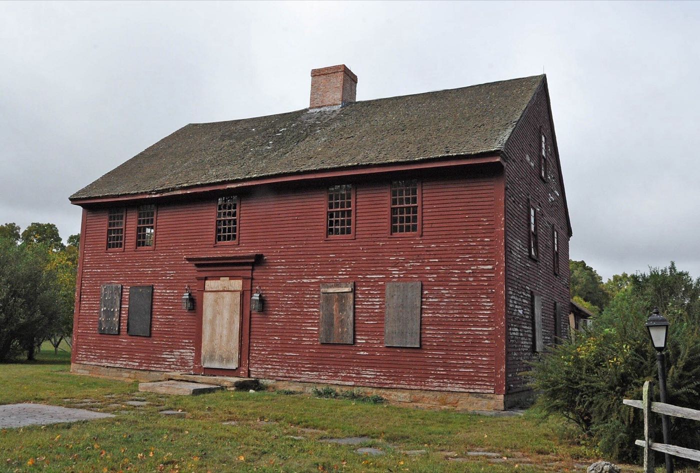
North Stonington sits in the southeast corner of Connecticut, bordering Rhode Island, and split off from Stonington by decree of the Connecticut Assembly in 1724. It remains a largely rural town of farms, woodland and small village centers, including North Stonington Village and Clarks Falls.
North Stonington uses ZIP code 06359.
| Area | Zip code | Where it is |
|---|---|---|
| North Stonington Village | 06359 | The town's historic village center along Route 2, listed as a National Register historic district in 1983. |
| Clarks Falls | 06359 | A rural settlement area first established by early settler Jeremiah Burch. |
North Stonington covers about 54.3 square miles and borders Voluntown, Griswold, Preston, Ledyard, Stonington, Westerly, Rhode Island and Hopkinton, Rhode Island. It was incorporated in 1724.
Start with North Stonington Village Historic District and Lantern Hill, then 1 more below.
A National Register historic district covering Route 2, Main Street and several surrounding roads, with 18th- and 19th-century homes and the town's original village core. Added to the register in 1983.
Route 2 and Main St, North Stonington, CT 06359
A 491-foot hill with white quartz cliffs long used as a landmark; local tradition holds it was called Tar Barrel Hill after tar barrels were burned there in 1814 to warn of a British approach.
North Stonington, CT 06359
A historic house southeast of the village on Route 2, added to the National Register of Historic Places in 1978.
Route 2, North Stonington, CT
North Stonington split off from Stonington and gained its name by decree of the Connecticut Assembly in 1724, after a long-running boundary dispute between the town's northern and southern congregations.
The first English settlers, Ezekiel Main and Jeremiah Burch, arrived in 1667, settling what became North Stonington Village and Clarks Falls respectively.
The town became a center of Baptist church growth in Connecticut during the Great Awakening of the 1740s, with its first Baptist meeting house built in 1743.
North Stonington is largely rural, with woodland, farmland and hills including Lantern Hill in its southwestern corner.
North Stonington is a rural, car-dependent town. Its village center along Route 2 has some sidewalks, but most of the town's farms and outlying roads require a car.
North Stonington, CT 06359
Clarks Falls, North Stonington, CT 06359
Approximate, without traffic.
North Stonington has no fixed-route public bus service and no passenger rail station; a car is needed to get around.
North Stonington's 2026–27 mill rate is 17.50, which is $17.50 of tax for every $1,000 of assessed value. Connecticut taxes a home at 70% of its appraised value, so every $100,000 of value costs about $1,225 a year in taxes at 17.50 mills.
| 12 months ending | Single-family | Condo |
|---|---|---|
| Sep 2024 | $370,00047 sales | – |
| Sep 2025 | $440,10061 sales | – |
October to September, state records. Text us for this month's sales.
17.50mills, fiscal year 2026–27
| Fiscal year | Town rate |
|---|---|
| 2022–23 | 28.45 |
| 2023–24 | 28.99 |
| 2024–25 | 28.88 |
| 2025–26 | 28.88 |
| 2026–27 | 17.50 |
North Stonington's town rate went from 28.45 in 2022–23 to 17.50 in 2026–27. Next revaluation: October 1, 2029.
What we check on a North Stonington purchase: CHFA limits, the flood map.
CHFA sets North Stonington's income and price limits for New London County. We check them with you before you shop.
See CHFA's limits mapShunock Brook and other watercourses running through North Stonington put some low-lying land in FEMA-mapped flood zones. We check FEMA's map before you offer.
FEMA's flood map for North StoningtonAll loans are subject to credit approval, underwriting, and property and program requirements. CHFA and USDA limits and eligibility are set by those agencies and change from time to time.

Send us a North Stonington address and we'll run the numbers, taxes included.
Who to call in North Stonington: Eversource for power.
North Stonington Town Hall. Each link opens that office's page on the town's website.
The short answers. Call or text us for the long ones.
North Stonington's 2026–27 mill rate is 17.50, which is $17.50 of tax for every $1,000 of assessed value. The motor vehicle rate is 17.50 mills.
Connecticut assesses homes at 70% of appraised value, so a $500,000 home would be assessed at about $350,000. At 17.50 mills that's about $6,125 a year, or about $510 a month. The actual bill depends on the town assessor's appraisal, not the price you pay.
In the 12 months from October 2024 through September 2025, the median single-family sale in North Stonington was $440,100 across 61 sales, compared with $370,000 the year before.
North Stonington's next revaluation takes effect October 1, 2029, on the state's schedule. The new assessments first show up on the tax bills due in July 2030.
North Stonington is in New London County, Connecticut.
North Stonington uses 06359.
No. North Stonington has no fixed-route bus service or passenger rail station.
North Stonington borders Voluntown and Griswold to the north, Preston to the northwest, Ledyard to the southwest, Stonington to the south, and Westerly and Hopkinton, Rhode Island to the east.
It split from Stonington and was named North Stonington by the Connecticut Assembly in 1724.
Neighbors of North Stonington in New London County and nearby. All New London County towns.