

Downtown Westfield / Park Square
59 Court St, Westfield, MA 01085
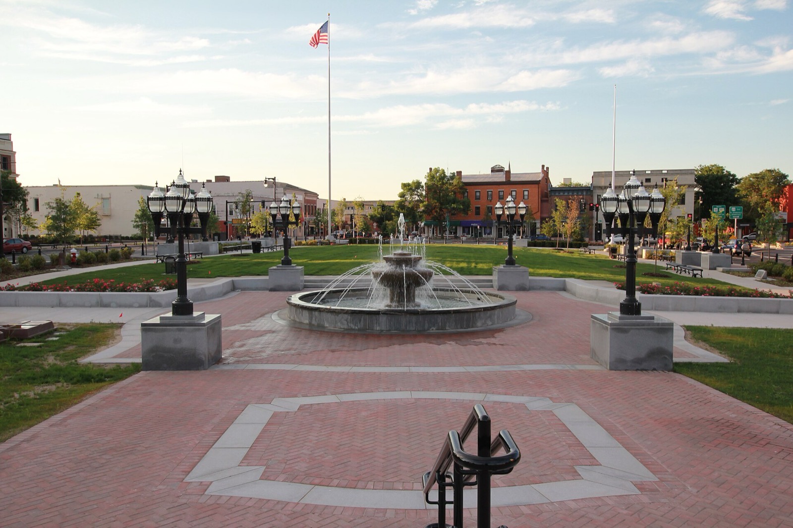
Westfield is a city in Hampden County, in the Pioneer Valley of western Massachusetts, about 10 miles west of Springfield. The Westfield River flows out of the Berkshire Hills through the center of the city, dividing it into a North Side and South Side, and the Little River also runs through town. Westfield-Barnes Regional Airport, used for general aviation and by the Massachusetts Air National Guard, sits within the city.
Westfield uses ZIP codes 01085 and 01086.
| Area | Zip code | Where it is |
|---|---|---|
| Downtown Westfield / Park Square | 01085 | The city center around Park Square (the Green), near the junction of Elm, Court, School and Main streets, where City Hall, the Westfield Athenaeum and downtown shops are located. |
| Wyben | 01085 | A rural section in the northwestern part of the city, toward the Montgomery and Russell town lines. |
Start with Stanley Park and Grandmother's Garden at Chauncey Allen Park, then 2 more below.
Nearly 300 acres of formal gardens, a carillon tower, walking trails, sports fields and a nature area near the Little River. There is no admission or parking fee. The main season runs from the first Saturday in May through the last Sunday in November, 7 a.m. until dusk.
400 Western Ave, Westfield, MA
Plan a visitA colonial-revival flower garden near downtown, open dawn to dusk with no admission charge.
Smith Ave, Westfield, MA
A children's museum with hands-on exhibits, open Thursday through Monday, 10 a.m. to 4 p.m. Admission is charged for visitors over 12 months old, with a reduced rate for seniors.
29 South Broad St, Westfield, MA
A state park on Route 202 with a swimming beach and picnicking along Hampton Ponds.
U.S. Route 202, Westfield, MA
Westfield was settled by colonists in 1660 and incorporated as a town on May 19, 1669; it was re-incorporated as a city on November 2, 1920.
In the early 19th century, the manufacture of bricks, whips, and cigars became economically important industries in Westfield.
In 1939, Westfield elected Alice Burke, the first female mayor in New England.
The Westfield River runs through the center of the city and the Little River borders Stanley Park, giving Westfield river frontage alongside a large city park, a state-park swimming pond, and a ridge trail along its eastern edge.
3 places in Westfield to try, including cafe and coffee shop. No one paid to be listed.
Cafe
A cafe serving coffee and food in Westfield, listed among current local cafes.
Coffee shop
A coffee and specialty goods shop in Westfield, listed among current local cafes.
Public library
The city's public library, on Elm Street near Park Square.
6 Elm St, Westfield, MA 01085 · westath.org
Downtown Westfield around Park Square has sidewalks connecting City Hall, the library and shops, and Stanley Park adds car-free trails, but most of the city's residential area, including Wyben and the outskirts, is built for driving.
59 Court St, Westfield, MA 01085
Approximate, without traffic.
PVTA bus routes R10 and B23 serve Westfield, connecting to Springfield and other Pioneer Valley communities. Westfield does not have its own Amtrak or Valley Flyer stop; the historic train depot building on North Elm Street no longer serves passenger rail, and the nearest Amtrak/Valley Flyer service is at Springfield Union Station, about 10 miles away, with additional stops in Northampton and Greenfield further north.
Westfield's FY2026 residential tax rate is $14.93 per $1,000 of assessed value. Commercial, industrial and personal property pay $29.17. Massachusetts assesses homes at full value, so each $100,000 of assessed value costs about $1,493 a year. The average single-family tax bill was $5,787, on an average assessed value of $387,639.
$14.93per $1,000, residential
Source: Massachusetts Division of Local Services, Tax Rates by Class and Average Single Family Tax Bill.
| Fiscal year | Residential rate |
|---|---|
| FY2022 | $18.49 |
| FY2023 | $16.98 |
| FY2024 | $15.97 |
| FY2025 | $15.18 |
| FY2026 | $14.93 |
What we check on a Westfield purchase: MassHousing limits, the flood map, the smoke certificate, foundations, municipal utility, smoke certificate.
MassHousing sets its own income and price limits for Hampden County. We check them with you before you shop.
MassHousing home loansThe Westfield River runs through the center of the city and the Little River also passes through town, putting some low-lying parcels near both waterways in FEMA-mapped flood zones. We check FEMA's map before you offer.
FEMA's flood map for WestfieldMassachusetts requires the seller to get a smoke and carbon monoxide certificate from the Westfield Fire Department before the sale closes.
The Massachusetts Geological Survey at UMass Amherst lists Westfield among the towns at moderate risk from pyrrhotite, a mineral linked to crumbling concrete foundations, based on distance from the Connecticut quarry that supplied the concrete. On a home with a poured concrete foundation, ask whether it has been tested.
UMass pyrrhotite guideWestfield Gas + Electric, a municipal utility owned by the city, supplies electric and gas service in Westfield rather than Eversource or National Grid. Buyers should set up service with WG+E directly ahead of closing.
Westfield Gas + ElectricMassachusetts law requires a smoke and carbon monoxide detector compliance certificate from the local fire department before a home sale can close. Westfield residents schedule this inspection through the city's Fire Department.
Smoke Detector & CO InformationAll loans are subject to credit approval, underwriting, and property and program requirements. MassHousing limits and eligibility are set by MassHousing and change from time to time.

We're licensed in Massachusetts. Send us a Westfield address and we'll run the numbers, taxes included.
Who to call in Westfield: Westfield Gas + Electric, the city's municipal utility, rather than Eversource or National Grid for power.
57 Twiss St, Westfield, MA 7 a.m.-2:45 p.m., Monday-Saturday
$35 annual permit
Transfer station detailsWestfield City Hall is at 59 Court St, Westfield, MA 01085. Main line: 413-572-6200.
Westfield's FY2026 residential tax rate is $14.93 per $1,000 of assessed value. Commercial, industrial and personal property pay $29.17. Massachusetts fiscal years run July 1 to June 30.
Massachusetts taxes homes on their full assessed value. If a home is assessed at $400,000, that's about $5,972 a year at $14.93 per $1,000. The bill uses the assessor's value, not the sale price.
Yes. Homes pay $14.93 per $1,000 and commercial, industrial and personal property pay $29.17.
The average single-family tax bill in Westfield was $5,787 for FY2026, on an average assessed value of $387,639.
Yes, the city's DPW collects trash and recycling curbside weekly. A separate Pay-As-You-Throw bag requirement applies only to trash dropped off at the Twiss Street Transfer Station, starting September 1, 2026.
Westfield Gas + Electric, a municipal utility owned by the city, supplies both electric and gas service.
No. Westfield does not have an Amtrak or Valley Flyer stop; the nearest is Springfield Union Station, about 10 miles away.
Westfield uses ZIP codes 01085 and 01086.
Neighbors of Westfield, including across the Connecticut line where it applies. All Massachusetts town guides.