

Agawam center
36 Main Street, Agawam, MA 01001
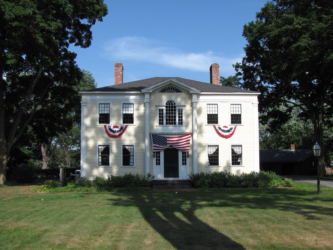
Agawam is a city in Hampden County on the western side of the Connecticut River, across from Springfield. It was set off from Springfield and incorporated as a town in 1855, then adopted a city form of government in 1973. The Feeding Hills section, separated from the city center by Line Street, has its own ZIP code and includes Provin Mountain, the city's highest point.
Agawam's main ZIP code, 01001, is cited as the lowest standard ZIP code in the contiguous United States; the Feeding Hills section uses its own ZIP code, 01030.
| Area | Zip code | Where it is |
|---|---|---|
| Agawam center | 01001 | Along Main Street, where City Hall, the Agawam Center Historic District, and municipal offices are located. |
| Feeding Hills | 01030 | The western section of the city, separated from Agawam center by Line Street, with its own ZIP code and post office, Provin Mountain, churches, and shopping areas. |
Start with Six Flags New England and Robinson State Park, then 3 more below.
A regional amusement and water park on the banks of the Connecticut River, tracing its roots to a trolley park called Gallup's Grove that opened in 1870, making it the oldest park in the Six Flags chain.
1623 Main St, Agawam, MA
An 852-acre day-use state park with frontage on the Westfield River, offering bicycling paths, walking trails, mountain biking, fishing, and canoeing.
428 North St, Agawam, MA
A city park with maintained walking paths, used for family walks and outdoor recreation.
Perry Lane, Agawam, MA
The city's highest point at 640 feet, part of the 110-mile Metacomet-Monadnock Trail, with views across the Connecticut River toward downtown Springfield.
Feeding Hills section, off the Metacomet-Monadnock Trail
A historic district along Main Street with 19th-century buildings including the Capt. Charles Leonard House, reflecting the city's history as part of Springfield before its 1855 incorporation.
Main Street, Agawam, MA
William Pynchon purchased the land that became Agawam on May 15, 1636, for goods including coats, hoes, hatchets, knives, and wampum.
Agawam was set off from Springfield and incorporated as its own town on May 17, 1855; it adopted a city form of government on January 1, 1973.
Six Flags New England traces its history to a trolley park called Gallup's Grove that opened on the site in 1870, making it the oldest park in the Six Flags chain.
Agawam's outdoor recreation centers on the Westfield and Connecticut rivers and on Provin Mountain in the Feeding Hills section.
3 places in Agawam to try, including american restaurant and bar and grill. No one paid to be listed.
American restaurant
A restaurant on Main Street serving burgers, sandwiches, and deli items.
141 Main Street, Agawam, MA · 141-mainstreet.com
Bar and grill
A bar and grill on Springfield Street.
63 Springfield St, Agawam, MA
Ice cream shop and restaurant
A Friendly's ice cream and restaurant location on Springfield Street; the chain traces its founding to 1935.
19 Springfield Street, Agawam, MA 01001 · locations.friendlysrestaurants.com/ll/US/MA/Agawam/19-springfield-street
The Main Street corridor in Agawam center has sidewalks connecting City Hall, the historic district, and nearby businesses, and Feeding Hills center has a similar walkable core, but most of the city, including its residential streets and Six Flags New England, is built around driving.
36 Main Street, Agawam, MA 01001
Approximate, without traffic.
The Pioneer Valley Transit Authority (PVTA) runs a bus route between Springfield's Union Station and Feeding Hills Center via Springfield Street, with select trips serving Maple/Walnut Streets and Pheasant Hill Apartments. Agawam has no train station of its own; the nearest Amtrak and Valley Flyer service is at Union Station in Springfield.
Agawam's FY2026 residential tax rate is $14.10 per $1,000 of assessed value. Commercial, industrial and personal property pay $26.67. Massachusetts assesses homes at full value, so each $100,000 of assessed value costs about $1,410 a year. The average single-family tax bill was $5,190, on an average assessed value of $368,117.
$14.10per $1,000, residential
Source: Massachusetts Division of Local Services, Tax Rates by Class and Average Single Family Tax Bill.
| Fiscal year | Residential rate |
|---|---|
| FY2022 | $16.11 |
| FY2023 | $15.78 |
| FY2024 | $14.54 |
| FY2025 | $14.64 |
| FY2026 | $14.10 |
What we check on a Agawam purchase: MassHousing limits, the flood map, the smoke certificate, smoke & co certificate, river flood zones.
MassHousing sets its own income and price limits for Hampden County. We check them with you before you shop.
MassHousing home loansAgawam sits on the western side of the Connecticut River, and Robinson State Park borders the Westfield River, putting low-lying parcels near both rivers in FEMA-mapped flood zones. We check FEMA's map before you offer.
FEMA's flood map for AgawamMassachusetts requires the seller to get a smoke and carbon monoxide certificate from the Agawam Fire Department before the sale closes. Call 413-786-2662 to schedule.
Agawam Fire Department pageSellers in Massachusetts need a smoke detector and carbon monoxide alarm compliance certificate from the local fire department before a home sale can close. The Agawam Fire Department publishes smoke and carbon monoxide alarm guidelines for residents to follow before an inspection.
Agawam Fire DepartmentParts of Agawam along the Connecticut River and near the Westfield River at Robinson State Park fall within FEMA-mapped flood zones. We check the flood map before you make an offer on a property near either river.
All loans are subject to credit approval, underwriting, and property and program requirements. MassHousing limits and eligibility are set by MassHousing and change from time to time.

We're licensed in Massachusetts. Send us a Agawam address and we'll run the numbers, taxes included.
Who to call in Agawam: Eversource for power.
Agawam City Hall is at 36 Main Street, Agawam, MA 01001. Main line: 413-786-0400.
Agawam's FY2026 residential tax rate is $14.10 per $1,000 of assessed value. Commercial, industrial and personal property pay $26.67. Massachusetts fiscal years run July 1 to June 30.
Massachusetts taxes homes on their full assessed value. If a home is assessed at $400,000, that's about $5,640 a year at $14.10 per $1,000. The bill uses the assessor's value, not the sale price.
Yes. Homes pay $14.10 per $1,000 and commercial, industrial and personal property pay $26.67.
The average single-family tax bill in Agawam was $5,190 for FY2026, on an average assessed value of $368,117.
Agawam uses curbside collection: eligible single-family households get one 65-gallon trash cart, collected weekly, and one 95-gallon recycling cart, collected every other week. The city's page does not describe a pay-as-you-throw program.
Eversource provides electric service in Agawam, and Eversource Gas of Massachusetts (formerly Columbia Gas of Massachusetts) provides natural gas.
Agawam center uses 01001, and the Feeding Hills section has its own ZIP code, 01030.
The Pioneer Valley Transit Authority runs a bus route between Springfield's Union Station and Feeding Hills Center via Springfield Street. Agawam has no train station of its own; the nearest Amtrak and Valley Flyer service is in Springfield.
Neighbors of Agawam, including across the Connecticut line where it applies. All Massachusetts town guides.