

Rowe center
321 Zoar Rd, Rowe, MA 01367
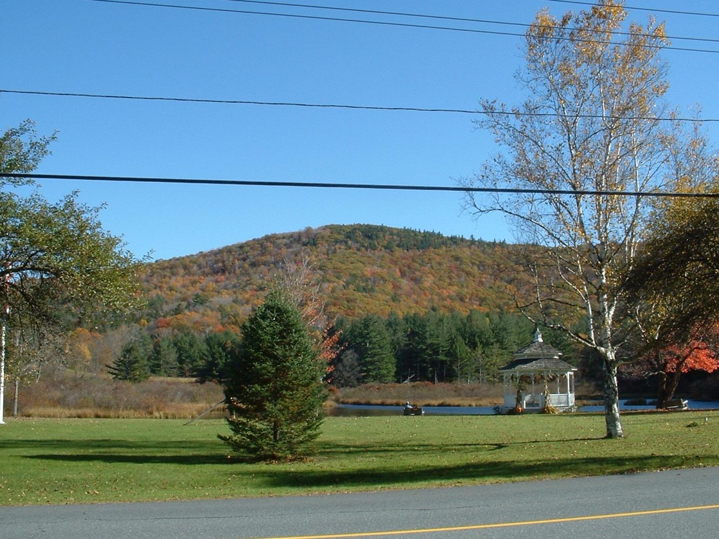
Rowe is a small hill town in the northwest corner of Franklin County, on the Vermont line, incorporated in 1785 and renamed for Boston merchant John Rowe after an earlier settlement called Myrifield. The Deerfield River runs along its eastern side, backed up into Sherman Reservoir near the Vermont border, and Adams Mountain rises above the town common and Mill Pond at the center of town. No state highway runs through Rowe.
Most of Rowe uses ZIP code 01367; the Monroe Bridge area uses 01350.
| Area | Zip code | Where it is |
|---|---|---|
| Rowe center | 01367 | Around the town common and Mill Pond on Zoar Road, with Adams Mountain rising behind it. |
| Davis | 01367 | A former mining village, now largely abandoned, in eastern Rowe near Pelham Lake. |
| Monroe Bridge | 01350 | A village along the Deerfield River on Rowe's western edge, shared with the town of Monroe. |
Start with Pelham Lake Park and Kemp-McCarthy Museum, then 1 more below.
A town-owned park with a lake, trails and the ruins of the former mining village of Davis nearby, used for swimming, fishing and walking.
Zoar Rd, Rowe, MA
A local history museum run by the Rowe Historical Society, covering the town's mining and farming past and the former Yankee Rowe nuclear plant.
282 Zoar Rd, Rowe, MA
A Unitarian Universalist retreat and conference center on Kings Highway Road, running a youth summer camp and adult workshops and retreats.
Kings Highway Rd, Rowe, MA
Rowe was settled by 1744 and incorporated in 1785, taking the name of Boston merchant John Rowe after an earlier period as a land grant called Myrifield.
The town's economy once included talc and soapstone mining around the village of Davis, now a largely abandoned site near Pelham Lake.
Yankee Rowe Nuclear Power Station, the first commercial nuclear power plant in New England, operated near the Sherman Dam from 1960 to 1992 and has since been decommissioned.
The Deerfield River and Sherman Reservoir along Rowe's western edge, plus Adams Mountain and Pelham Lake Park in the town center, are the focus of outdoor recreation.
Rowe center, a small common with a gazebo and Mill Pond, can be crossed on foot, but this rural, low-density town with no state highway has no walkable commercial district and requires a car to get around.
321 Zoar Rd, Rowe, MA 01367
Approximate, without traffic.
Rowe has no fixed-route public transit, bus service, or train station. The nearest bus and air service is in North Adams, and the nearest Amtrak station is in Greenfield.
Rowe's FY2026 residential tax rate is $5.24 per $1,000 of assessed value. Commercial, industrial and personal property pay $11.42. Massachusetts assesses homes at full value, so each $100,000 of assessed value costs about $524 a year. The average single-family tax bill was $1,661, on an average assessed value of $316,902.
$5.24per $1,000, residential
Source: Massachusetts Division of Local Services, Tax Rates by Class and Average Single Family Tax Bill.
| Fiscal year | Residential rate |
|---|---|
| FY2022 | $5.33 |
| FY2023 | $5.18 |
| FY2024 | $5.01 |
| FY2025 | $5.14 |
| FY2026 | $5.24 |
What we check on a Rowe purchase: MassHousing limits, the flood map, the smoke certificate, well & septic, municipal fiber.
MassHousing sets its own income and price limits for Franklin County. We check them with you before you shop.
MassHousing home loansFlood zones are set address by address. We check FEMA's map before you offer.
FEMA's flood map for RoweMassachusetts requires the seller to get a smoke and carbon monoxide certificate from the Rowe Fire Department before the sale closes.
Rowe has no public water or sewer system, so all homes use private wells and septic systems. Massachusetts requires a Title 5 septic inspection before a home on septic can be sold, and we build that timeline into your preapproval.
Rowe's Municipal Light Plant is part of the regional WiredWest fiber network, so broadband access, often a concern in rural hilltowns, is worth confirming directly for a specific address.
All loans are subject to credit approval, underwriting, and property and program requirements. MassHousing limits and eligibility are set by MassHousing and change from time to time.

We're licensed in Massachusetts. Send us a Rowe address and we'll run the numbers, taxes included.
Who to call in Rowe: National Grid for power.
Rowe Town Hall is at 321 Zoar Rd, Rowe, MA 01367. Main line: 413-339-5520.
Rowe's FY2026 residential tax rate is $5.24 per $1,000 of assessed value. Commercial, industrial and personal property pay $11.42. Massachusetts fiscal years run July 1 to June 30.
Massachusetts taxes homes on their full assessed value. If a home is assessed at $400,000, that's about $2,096 a year at $5.24 per $1,000. The bill uses the assessor's value, not the sale price.
Yes. Homes pay $5.24 per $1,000 and commercial, industrial and personal property pay $11.42.
The average single-family tax bill in Rowe was $1,661 for FY2026, on an average assessed value of $316,902.
Rowe is in Franklin County, Massachusetts.
Most of Rowe uses ZIP code 01367; the Monroe Bridge area uses 01350.
No. Rowe residents use the town transfer station and recycling center.
National Grid is the electric utility for Rowe. The town separately operates a municipal fiber broadband network through WiredWest.
Rowe is about 23 miles from Greenfield, roughly a 35-40 minute drive.
No. Rowe has no public water or sewer system; homes use private wells and septic systems.
Neighbors of Rowe, including across the Connecticut line where it applies. All Massachusetts town guides.