

First-time buyer programs
MassHousing sets its own income and price limits for Berkshire County. We check them with you before you shop.
MassHousing home loans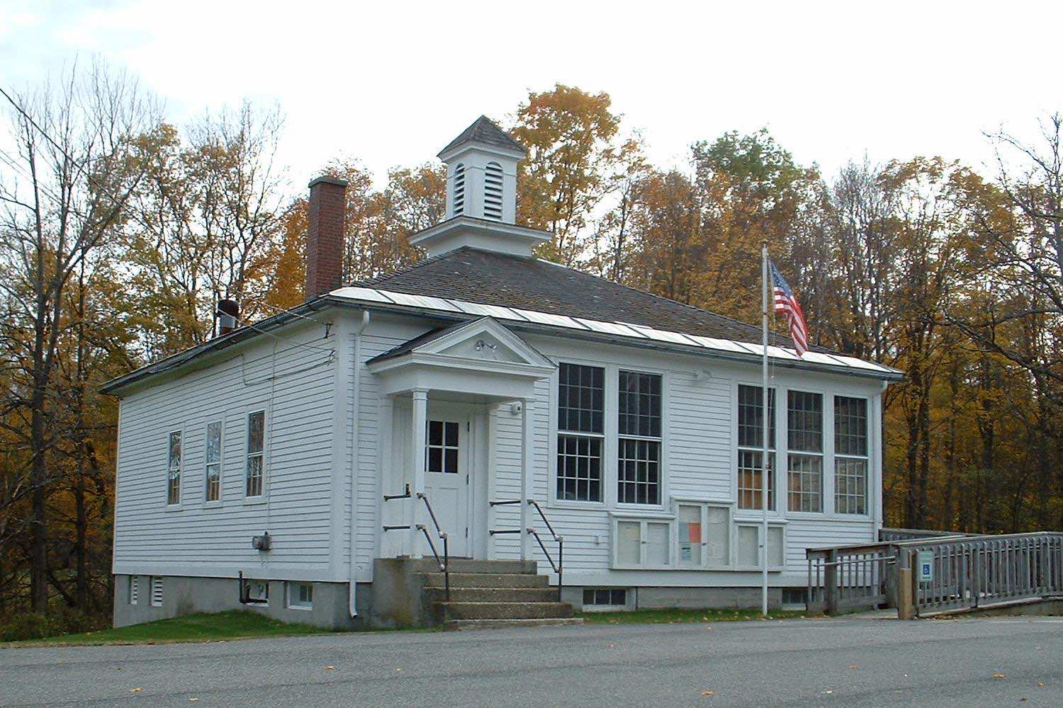
New Ashford is a small town in a Taconic Mountains valley in Berkshire County, settled in 1762 and incorporated in 1835, named after Ashford, Connecticut, the origin of its founding families. Mount Greylock State Reservation and Saddle Ball Mountain, the town's highest point at 3,220 feet, lie on its eastern edge, with the Appalachian Trail crossing through town.
New Ashford uses ZIP code 01237.
| Area | Zip code | Where it is |
|---|---|---|
| New Ashford center | 01237 | Along Mallery Road, where Town Hall is located. |
Start with Mount Greylock State Reservation and Appalachian Trail, then 1 more below.
The reservation surrounding Massachusetts's highest peak reaches into eastern New Ashford, including Saddle Ball Mountain, with the Mount Greylock Scenic Drive passing through this part of town.
New Ashford, MA
The long-distance trail crosses through New Ashford on its route through the Mount Greylock area.
New Ashford, MA
The town's small historic Town Hall, home to a wooden ballot box dating to 1920, when New Ashford was noted for casting one of the nation's first votes in presidential elections.
188 Mallery Rd, New Ashford, MA
New Ashford was settled in 1762 and incorporated as a town on November 4, 1835, named for Ashford, Connecticut.
The town has been noted for casting some of the first votes in the nation in U.S. presidential elections since 1916, with Phoebe Jordan reportedly the first woman to vote in a national election there, on November 2, 1920.
A historic wooden ballot box from 1920 remains in the town hall.
New Ashford's eastern edge reaches into Mount Greylock State Reservation, including Saddle Ball Mountain, the town's highest point, with the Appalachian Trail and Mount Greylock Scenic Drive both crossing this part of town.
New Ashford has no sidewalked village center; it is a small, rural valley town built for driving, with U.S. Route 7 as its main road.
Approximate, without traffic.
The Berkshire Regional Transit Authority provides bus and paratransit service reaching New Ashford. The nearest rail service is in Pittsfield.
New Ashford's FY2026 residential tax rate is $5.66 per $1,000 of assessed value. Massachusetts assesses homes at full value, so each $100,000 of assessed value costs about $566 a year. The average single-family tax bill was $2,795, on an average assessed value of $493,775.
$5.66per $1,000, residential
Source: Massachusetts Division of Local Services, Tax Rates by Class and Average Single Family Tax Bill.
| Fiscal year | Residential rate |
|---|---|
| FY2022 | $10.94 |
| FY2023 | $9.44 |
| FY2024 | $8.48 |
| FY2025 | $5.66 |
| FY2026 | $5.66 |
What we check on a New Ashford purchase: MassHousing limits, the flood map, the smoke certificate, well & septic, state reservation land.
MassHousing sets its own income and price limits for Berkshire County. We check them with you before you shop.
MassHousing home loansSmall streams draining the Taconic and Greylock ranges cross New Ashford's valley; low-lying land near them can fall within FEMA-mapped flood zones. We check FEMA's map before you offer.
FEMA's flood map for New AshfordMassachusetts requires the seller to get a smoke and carbon monoxide certificate from the New Ashford Fire Department before the sale closes.
New Ashford Fire Department pageNew Ashford has no townwide public water or sewer system; properties use private wells and septic systems. Buyers should confirm well and septic condition, including a Title 5 inspection, before closing.
Mount Greylock State Reservation covers part of eastern New Ashford, which can affect nearby lot lines and buildable land. Check reservation boundaries near any property you're considering.
All loans are subject to credit approval, underwriting, and property and program requirements. MassHousing limits and eligibility are set by MassHousing and change from time to time.

We're licensed in Massachusetts. Send us a New Ashford address and we'll run the numbers, taxes included.
Who to call in New Ashford.
Saturdays 7:00-10:00 AM
Transfer station detailsNew Ashford Town Hall is at 188 Mallery Rd, New Ashford, MA 01237.
New Ashford's FY2026 residential tax rate is $5.66 per $1,000 of assessed value. Massachusetts fiscal years run July 1 to June 30.
Massachusetts taxes homes on their full assessed value. If a home is assessed at $400,000, that's about $2,264 a year at $5.66 per $1,000. The bill uses the assessor's value, not the sale price.
No. New Ashford uses a single rate of $5.66 per $1,000 for all property classes.
The average single-family tax bill in New Ashford was $2,795 for FY2026, on an average assessed value of $493,775.
New Ashford is in Berkshire County.
New Ashford uses ZIP code 01237.
New Ashford is about 11 miles from Pittsfield.
The Berkshire Regional Transit Authority provides bus and paratransit service; the nearest rail service is in Pittsfield.
New Ashford borders Williamstown, Adams, Cheshire, Lanesborough and Hancock.
No. The town runs a Saturday-morning recycling and transfer drop-off, coordinated with the Northern Berkshire Solid Waste District.
Neighbors of New Ashford, including across the Connecticut line where it applies. All Massachusetts town guides.