

First-time buyer programs
MassHousing sets its own income and price limits for Berkshire County. We check them with you before you shop.
MassHousing home loans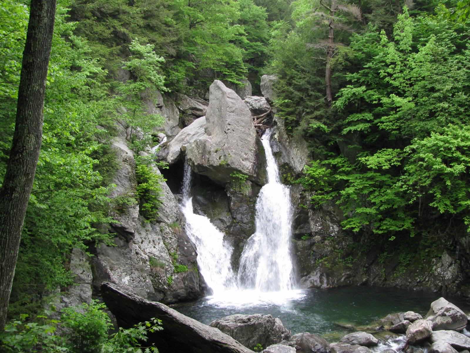
First settled in 1692 and incorporated in 1779, it holds Mount Everett, the highest point in the southern Taconics at 2,602 feet, and Mount Frissell, whose summit sits in Mount Washington even though its slope holds the highest point in Connecticut. Only four roads lead out of town, and just one, East Street, connects to the rest of Massachusetts.
Mount Washington uses ZIP code 01258.
| Area | Zip code | Where it is |
|---|---|---|
| Mount Washington center | 01258 | Along Plantain Pond Road, where Town Hall is located. |
Start with Bash Bish Falls State Park and Mount Everett State Reservation, then 2 more below.
Massachusetts's tallest single-drop waterfall, reached by trail from the state park, within Mount Washington State Forest.
Falls Rd, Mount Washington, MA
A reservation centered on Mount Everett, the highest point in the southern Taconic range at 2,602 feet, with hiking trails including a section of the Appalachian Trail.
Mount Washington, MA
A mountain whose summit lies in Mount Washington, notable because its southern slope holds the highest point in Connecticut.
Mount Washington, MA
A ridge along the Appalachian Trail near Mount Everett, with open-ledge views.
Mount Washington, MA
Mount Washington was first settled in 1692 and incorporated as a town in 1779.
Only four roads lead out of Mount Washington, and just one, East Street, connects the town to the rest of Massachusetts.
Mount Washington sits almost entirely within protected forest and reservation land, including Mount Everett State Reservation and Mount Washington State Forest, home to Bash Bish Falls and a stretch of the Appalachian Trail along Mount Race and Mount Frissell.
Mount Washington has no sidewalked village center; it is entirely rural mountain terrain built for driving, with only four roads leading out of town.
Approximate, without traffic.
Mount Washington has no fixed-route public transit. The nearest rail and bus service is in Great Barrington, and the nearest Interstate 90 exit is in West Stockbridge.
Mount Washington's FY2026 residential tax rate is $5.97 per $1,000 of assessed value. Massachusetts assesses homes at full value, so each $100,000 of assessed value costs about $597 a year. The average single-family tax bill was $3,720, on an average assessed value of $623,166.
$5.97per $1,000, residential
Source: Massachusetts Division of Local Services, Tax Rates by Class and Average Single Family Tax Bill.
| Fiscal year | Residential rate |
|---|---|
| FY2022 | $6.11 |
| FY2023 | $5.57 |
| FY2024 | $6.32 |
| FY2025 | $6.08 |
| FY2026 | $5.97 |
What we check on a Mount Washington purchase: MassHousing limits, the flood map, the smoke certificate, well & septic, limited road access, state forest and reservation land.
MassHousing sets its own income and price limits for Berkshire County. We check them with you before you shop.
MassHousing home loansBash Bish Brook and other headwater streams draining Mount Everett and the Taconic plateau cross town; low-lying land near them can fall within FEMA-mapped flood zones. We check FEMA's map before you offer.
FEMA's flood map for Mount WashingtonMassachusetts requires the seller to get a smoke and carbon monoxide certificate from the Mount Washington Fire Department before the sale closes. Call 413-717-7622 to schedule.
Mount Washington Fire Department pageMount Washington has no townwide public water or sewer system; properties use private wells and septic systems, permitted through the Board of Health. Buyers should confirm well and septic condition, including a Title 5 inspection, before closing.
Mount Washington has just four roads leading out of town, with only East Street connecting directly to the rest of Massachusetts. Check winter road maintenance and drive times to services before buying.
Mount Everett State Reservation and Mount Washington State Forest cover a large share of the town, which can affect nearby lot lines, access roads and buildable land. Check boundaries near any property you're considering.
All loans are subject to credit approval, underwriting, and property and program requirements. MassHousing limits and eligibility are set by MassHousing and change from time to time.

We're licensed in Massachusetts. Send us a Mount Washington address and we'll run the numbers, taxes included.
Who to call in Mount Washington.
Mount Washington Town Hall is at 2 Plantain Pond Rd, Mount Washington, MA 01258. Hours: Mondays 11 AM-3 PM; Tuesdays 9 AM-2 PM; other times by appointment. Main line: 413-528-2839.
Mount Washington's FY2026 residential tax rate is $5.97 per $1,000 of assessed value. Massachusetts fiscal years run July 1 to June 30.
Massachusetts taxes homes on their full assessed value. If a home is assessed at $400,000, that's about $2,388 a year at $5.97 per $1,000. The bill uses the assessor's value, not the sale price.
No. Mount Washington uses a single rate of $5.97 per $1,000 for all property classes.
The average single-family tax bill in Mount Washington was $3,720 for FY2026, on an average assessed value of $623,166.
Mount Washington is in Berkshire County.
Mount Washington uses ZIP code 01258.
Mount Washington is about 33 miles from Pittsfield.
No confirmed curbside service; the town operates a transfer station.
Mount Washington borders Egremont and Sheffield in Massachusetts, Salisbury, Connecticut, and Ancram, Copake and North East in New York.
Massachusetts's tallest single-drop waterfall, reached by trail within Mount Washington State Forest.
Neighbors of Mount Washington, including across the Connecticut line where it applies. All Massachusetts town guides.