

Mattapoisett center
16 Main Street, Mattapoisett, MA 02739
Mattapoisett is a town in Plymouth County on Buzzards Bay, about 9 miles east of New Bedford and 60 miles south of Boston. Settled in 1750 and incorporated in 1857 after separating from Rochester, its name comes from a Wampanoag word for a place of resting. Shipyards along its harbor built roughly 400 vessels between the 1740s and 1870s, including the whaling ship Acushnet, on which Herman Melville once sailed; when the whaling industry declined, the town became a summer harbor community.
Mattapoisett uses a single ZIP code, 02739, for the entire town.
| Area | Zip code | Where it is |
|---|---|---|
| Mattapoisett center | 02739 | Around Town Hall and Shipyard Park on Water Street, at the head of Mattapoisett Harbor. |
| Cannonville / Ned's Point | 02739 | The neighborhood around Ned's Point, at the harbor's entrance on Buzzards Bay. |
Start with Ned's Point Light and Shipyard Park, then 2 more below.
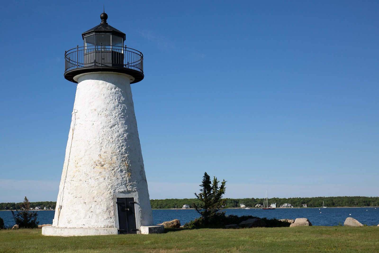
An 1838 stone lighthouse with a cantilevered granite stairway of 32 steps set into the tower wall without mortar, marking the entrance to Mattapoisett Harbor. It was named for local farmer Ned Dexter and listed on the National Register of Historic Places in 1987.
Ned's Point Road, Mattapoisett, MA
A waterfront park in the town center on Water Street, on the site of the shipyards that built roughly 400 vessels for the town's shipbuilding and whaling trade between the 1740s and 1870s.
Water Street, Mattapoisett, MA
A 210-acre state reservation with rocky shoreline, open fields, and wooded trails leading to a rocky beach on Buzzards Bay. It was protected from residential development and established as a reservation in 1999.
Brandt Beach Road, Mattapoisett, MA
The town's public library on Barstow Street.
7 Barstow Street, Mattapoisett, MA
Mattapoisett was settled in 1750 and incorporated as a separate town from Rochester on May 21, 1857; its name comes from a Wampanoag word meaning a place of resting.
Shipyards along Mattapoisett Harbor built about 400 vessels between the 1740s and the 1870s, including the whaling ship Acushnet, which Herman Melville sailed on before writing Moby-Dick.
Ned's Point Light was built in 1838 at the harbor entrance and named for local farmer Ned Dexter; it was added to the National Register of Historic Places in 1987.
Mattapoisett's outdoor recreation follows Buzzards Bay, from Shipyard Park and Ned's Point in the harbor to the shoreline trails at Nasketucket Bay State Reservation.
3 places in Mattapoisett to try, including seafood restaurant, sushi bar, and fish market and american restaurant. No one paid to be listed.
Seafood restaurant, sushi bar, and fish market
A seafood restaurant, sushi bar, and fish market on Route 6.
83 Marion Road, Mattapoisett, MA 02739 · turksseafood.com
American restaurant
A casual dining restaurant on Water Street overlooking Shipyard Park and the harbor, with a bar and outdoor patio seating.
13 Water Street, Mattapoisett, MA 02739 · theinnonthepark.com
Seafood and ice cream stand
A seasonal seafood and ice cream stand on County Road.
98 County Road, Mattapoisett, MA 02739
The town center around Shipyard Park, Water Street, and Main Street has sidewalks connecting the harbor, shops, and Town Hall, but most of Mattapoisett, spread along the bay and Route 6, is built around driving.
16 Main Street, Mattapoisett, MA 02739
Approximate, without traffic.
Mattapoisett has no train station; the nearest regional rail and bus connections run through New Bedford and Providence. Interstate 195 (Exit 31A/B) and U.S. Route 6 are the town's main highway connections.
Mattapoisett's FY2026 residential tax rate is $10.24 per $1,000 of assessed value. Massachusetts assesses homes at full value, so each $100,000 of assessed value costs about $1,024 a year. The average single-family tax bill was $8,244, on an average assessed value of $805,060.
$10.24per $1,000, residential
Source: Massachusetts Division of Local Services, Tax Rates by Class and Average Single Family Tax Bill.
| Fiscal year | Residential rate |
|---|---|
| FY2022 | $12.40 |
| FY2023 | $11.25 |
| FY2024 | $10.51 |
| FY2025 | $10.76 |
| FY2026 | $10.24 |
What we check on a Mattapoisett purchase: MassHousing limits, the flood map, the smoke certificate, smoke & co certificate, coastal flood zones, private wells and septic.
MassHousing sets its own income and price limits for Plymouth County. We check them with you before you shop.
MassHousing home loansAs a harbor town on Buzzards Bay, Mattapoisett has FEMA-mapped coastal flood zones along its shoreline, including areas near Shipyard Park, Ned's Point, and Nasketucket Bay. We check FEMA's map before you offer.
FEMA's flood map for MattapoisettMassachusetts requires the seller to get a smoke and carbon monoxide certificate from the Mattapoisett Fire Department before the sale closes. Call 508-758-4150 to schedule.
Mattapoisett Fire Department pageSellers in Massachusetts need a smoke detector and carbon monoxide alarm compliance certificate from the local fire department before a home sale can close. Requirements vary by when the home was permitted; contact the Mattapoisett Fire Department to schedule the inspection.
Mattapoisett Fire DepartmentMattapoisett's harbor and Buzzards Bay shoreline put many waterfront and near-waterfront parcels in FEMA-mapped flood zones. We check the flood map and flood insurance requirements before you make an offer here.
While the town's Water & Sewer Department serves parts of Mattapoisett, ask whether a specific property is on public water and sewer or on a private well and septic system, which would require a Title 5 inspection before sale.
Mattapoisett Board of HealthAll loans are subject to credit approval, underwriting, and property and program requirements. MassHousing limits and eligibility are set by MassHousing and change from time to time.

We're licensed in Massachusetts. Send us a Mattapoisett address and we'll run the numbers, taxes included.
Who to call in Mattapoisett: Eversource for power.
16 Main Street, Mattapoisett, MA 02739 Tuesday-Saturday, 8:00 am to 3:00 pm; closed Sunday and Monday
Transfer station detailsMattapoisett Town Hall is at 16 Main Street, Mattapoisett, MA 02739. Hours: Monday-Friday, 8 am to 4 pm. Main line: 508-758-4100.
Mattapoisett's FY2026 residential tax rate is $10.24 per $1,000 of assessed value. Massachusetts fiscal years run July 1 to June 30.
Massachusetts taxes homes on their full assessed value. If a home is assessed at $400,000, that's about $4,096 a year at $10.24 per $1,000. The bill uses the assessor's value, not the sale price.
No. Mattapoisett uses a single rate of $10.24 per $1,000 for all property classes.
The average single-family tax bill in Mattapoisett was $8,244 for FY2026, on an average assessed value of $805,060.
No. Mattapoisett residents bring trash and recycling to the town Transfer Station on Main Street, open Tuesday through Saturday from 8 am to 3 pm.
Eversource provides electric service in Mattapoisett.
Mattapoisett uses a single ZIP code, 02739, for the whole town.
The town's Water & Sewer Department supplies water from four groundwater wells in the Mattapoisett River Valley and pumps sewerage to Fairhaven's treatment plant; ask about a specific property's connection, since some areas may rely on private wells or septic.
Mattapoisett is about 9 miles east of New Bedford and about 60 miles south of Boston.
Ned's Point Light is an 1838 stone lighthouse at the entrance to Mattapoisett Harbor, listed on the National Register of Historic Places in 1987.
Neighbors of Mattapoisett, including across the Connecticut line where it applies. All Massachusetts town guides.