

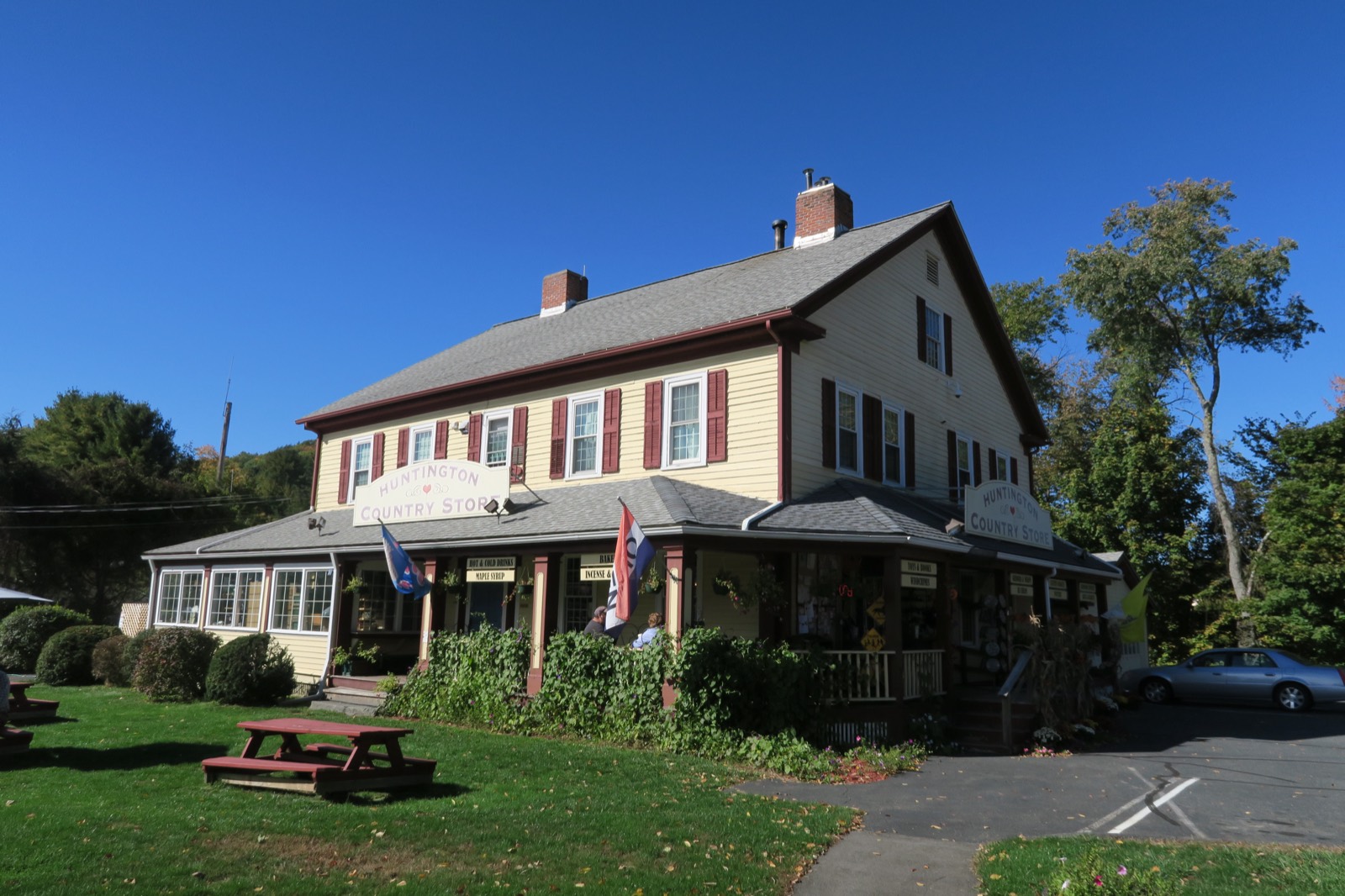
Living in Huntington, Massachusetts
Huntington is a Hampshire County hill town on the Westfield River, first settled in 1760 by migrants from Connecticut and incorporated as Norwich in 1775. It was renamed for Charles P. Huntington of Northampton and re-incorporated as Huntington in 1855. U.S. Route 20 follows the Westfield River through town, about 12 miles northwest of Westfield.
Huntington at a glance
- $14.77Residential tax rate per $1,000, FY2026
- $4,714Average single-family tax bill, FY2026
- HampshireCounty
- 1775Year incorporated
Huntington's villages and zip codes
Huntington uses a single ZIP code, 01050.
| Area | Zip code | Where it is |
|---|---|---|
| Huntington | 01050 | The main village, in the south of town along U.S. Route 20 and the Westfield River, where Town Hall and the Huntington Public Library are located. |
| Norwich / Norwich Bridge | 01050 | A village area in the center of town, near where the Western Railroad once stopped. |
| Knightville | 01050 | A former village north of the town center that was cleared, along with neighboring Indian Hollow, for the Army Corps of Engineers' Knightville Dam flood-control project, built 1939-1941. |
| Littleville | 01050 | A section of town home to Littleville Elementary School, part of the Gateway Regional School District. |
Things to do in Huntington, MA
Start with Knightville Dam and Huntington Public Library, then 1 more below.
Knightville Dam
An Army Corps of Engineers flood-control dam on the Westfield River, built 1939-1941 after the destructive 1936 flood. It does not normally hold back a reservoir and is credited with averting hundreds of millions of dollars in downstream flood damage over the decades since.
Route 112 area, Huntington, MA
Huntington Public Library
The town's public library, on East Main Street in the village center.
7 East Main St, Huntington, MA 01050
Westfield River corridor
U.S. Route 20 runs alongside the Westfield River through the village, with river access points along the way.
Route 20, Huntington, MA
A little history
Huntington was settled beginning in 1760 by migrants from Connecticut and was first incorporated as Norwich in 1775; it was renamed for Charles P. Huntington of Northampton and re-incorporated as Huntington on March 5, 1855.
The Western Railroad reached the area in 1841 and later became part of the Boston and Albany Railroad; the Huntington Textile Company supplied cloth to the U.S. military during both World Wars before closing in 1952.
The Army Corps of Engineers built the Knightville Dam from 1939 to 1941 after a damaging 1936 flood, a flood-control project on the Westfield River that eliminated the villages of Knightville and Indian Hollow in the northern part of town.
Parks, trails and outdoors in Huntington
The Westfield River runs through Huntington alongside U.S. Route 20, and the Army Corps of Engineers' Knightville Dam manages flooding on this stretch of the river.
- Westfield RiverThe river running through the village center along Route 20, on its way toward Westfield.
- Knightville DamA flood-control dam and its surrounding land, managed by the U.S. Army Corps of Engineers.
Walkability and getting around Huntington
Huntington's village center has a small walkable cluster along East Main Street and Route 20, but the town overall is rural hill-town terrain that requires a car.
Drive times
- Westfield, about 12 miles
Approximate, without traffic.
By bus or train
Huntington has no confirmed fixed-route public transit and no train station; U.S. Route 20 is the main route through town.
Huntington property taxes
Huntington's FY2026 residential tax rate is $14.77 per $1,000 of assessed value. Massachusetts assesses homes at full value, so each $100,000 of assessed value costs about $1,477 a year. The average single-family tax bill was $4,714, on an average assessed value of $319,171.
Huntington's FY2026 tax rates
$14.77per $1,000, residential
- Residential$14.77 per $1,000
- Average single-family assessed value$319,171
- Average single-family tax bill$4,714
- Motor vehicle excise (statewide)$25 per $1,000 of value
Source: Massachusetts Division of Local Services, Tax Rates by Class and Average Single Family Tax Bill.
How the residential rate has changed
| Fiscal year | Residential rate |
|---|---|
| FY2022 | $17.56 |
| FY2023 | $17.05 |
| FY2024 | $15.66 |
| FY2025 | $15.40 |
| FY2026 | $14.77 |
Look up a Huntington property
- FEMA flood mapWhether a lender will require flood insurance
- Town ClerkVital records and town records
- Assessors' officeQuestions about a value
- Registry of DeedsDeeds and mortgages for the county
Buying a home in Huntington
What we check on a Huntington purchase: MassHousing limits, the flood map, the smoke certificate, well & septic, flood-control history.
First-time buyer programs
MassHousing sets its own income and price limits for Hampshire County. We check them with you before you shop.
MassHousing home loansCheck the flood zone first
The Westfield River's East Branch runs through Huntington. The Army Corps of Engineers' Knightville Dam controls flooding on this stretch of river, though land outside the dam's project area can still fall in FEMA-mapped flood zones. We check FEMA's map before you offer.
FEMA's flood map for HuntingtonSmoke and CO certificate
Massachusetts requires the seller to get a smoke and carbon monoxide certificate from the Huntington Fire Department before the sale closes.
Coverage from the town water system is limited
Huntington's Water Department runs a public groundwater system, but it does not appear to serve the whole town, and no town sewer department is listed. Many properties likely rely on private wells and septic systems; confirm which utilities serve a specific address.
Knightville Dam manages river flooding north of the village
The Army Corps of Engineers built the Knightville Dam on the Westfield River after the 1936 flood; it eliminated the former villages of Knightville and Indian Hollow. Buyers near the river should check current FEMA flood maps.
All loans are subject to credit approval, underwriting, and property and program requirements. MassHousing limits and eligibility are set by MassHousing and change from time to time.

Thinking about buying in Huntington?
We're licensed in Massachusetts. Send us a Huntington address and we'll run the numbers, taxes included.
Moving to Huntington: utilities, trash and town hall
Who to call in Huntington.
- WaterHuntington Water Department operates a public groundwater system serving part of town.
- Registry of Motor VehiclesUpdate your address with the RMV within 30 days. Excise tax goes to the city or town where the car is garaged.Mass. RMV
Town Hall offices and contacts
Huntington Town Hall.
- Town HallMain line and website
- Town ClerkLand records, vital records and elections.
- Board of AssessorsProperty values and assessments.
- Board of HealthSeptic and well permitting.
- Fire DepartmentFire prevention and smoke/CO alarm certificates for home sales.
- Water DepartmentHuntington's public groundwater system.
- Huntington Public LibraryThe town's public library.
- Gateway Regional School DistrictLittleville Elementary School (PK-4) is in Huntington; Gateway Regional Middle School and High School serve the district's member towns.
Huntington, MA FAQ: taxes and town services
What is the property tax rate in Huntington, MA?
Huntington's FY2026 residential tax rate is $14.77 per $1,000 of assessed value. Massachusetts fiscal years run July 1 to June 30.
How much are property taxes on a $400,000 home in Huntington?
Massachusetts taxes homes on their full assessed value. If a home is assessed at $400,000, that's about $5,908 a year at $14.77 per $1,000. The bill uses the assessor's value, not the sale price.
Does Huntington have a split tax rate?
No. Huntington uses a single rate of $14.77 per $1,000 for all property classes.
What is the average single-family tax bill in Huntington?
The average single-family tax bill in Huntington was $4,714 for FY2026, on an average assessed value of $319,171.
What county is Huntington, MA in?
Huntington is in Hampshire County.
What is Huntington's ZIP code?
Huntington uses a single ZIP code, 01050.
How far is Huntington from Westfield?
Huntington is about 12 miles from Westfield via U.S. Route 20.
What school district serves Huntington?
Gateway Regional School District. Littleville Elementary School (PK-4) is in Huntington, with Gateway Regional Middle School and High School serving the district.
What happened to the villages of Knightville and Indian Hollow?
They were cleared in the northern part of town for the Army Corps of Engineers' Knightville Dam, a flood-control project built from 1939 to 1941.
Is there public transit in Huntington?
No fixed-route public transit is confirmed for the town, and there is no train station.
Towns near Huntington
Neighbors of Huntington, including across the Connecticut line where it applies. All Massachusetts town guides.
Sources
- Huntington, Massachusetts - Wikipedia: en.wikipedia.org
- Westfield River (Knightville Dam) - Wikipedia: en.wikipedia.org
- Chester, Massachusetts - Wikipedia (borders): en.wikipedia.org
- Worthington, Massachusetts - Wikipedia (borders): en.wikipedia.org
- Montgomery, Massachusetts - Wikipedia (borders): en.wikipedia.org
- Russell, Massachusetts - Wikipedia (borders): en.wikipedia.org
- Huntington, Massachusetts - City-Data.com profile: city-data.com
- Huntington Country Store photo, Wikimedia Commons: commons.wikimedia.org
- Tax rates and average single-family value and tax bill: Massachusetts Division of Local Services, Tax Rates by Class and Average Single Family Tax Bill.
- Motor vehicle excise: M.G.L. c. 60A, $25 per $1,000 of value statewide.
- Walkability: Walk Score®, provided live by Walk Score.
- Photo: John Phelan, CC BY-SA 4.0, via Wikimedia Commons.
- Checked September 25, 2026.