

Hawley center
8 Pudding Hollow Rd, Hawley, MA 01339
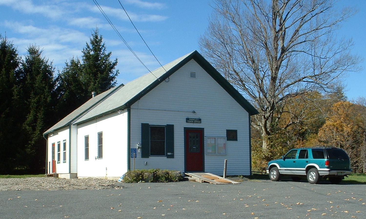
Hawley is a small hill town in southwestern Franklin County, settled in 1760 and incorporated in 1792 as Hatfield Reserve before being renamed for Revolutionary-era leader Joseph Hawley of Northampton. The Chickley River runs through town, which sits at an elevation of about 1,404 feet, and much of Hawley's land is state forest, including part of Kenneth Dubuque Memorial State Forest and a corner of Mohawk Trail State Forest. Route 8A is the town's main road.
Hawley uses a single ZIP code, 01339, for the whole town.
| Area | Zip code | Where it is |
|---|---|---|
| Hawley center | 01339 | Around the Town Office on Pudding Hollow Road. |
| West Hawley | 01339 | A smaller settlement on the western side of town along the Chickley River, with the West Hawley Congregational Church. |
Start with Hawley Bog and Kenneth Dubuque Memorial State Forest, then 1 more below.
One of the few bogs in Massachusetts preserved in its natural state, a Nature Conservancy property with a boardwalk trail through a rare wetland habitat.
Hawley, MA
A state forest including Parker Hill, the highest peak in Hawley, with trails for hiking and hunting.
Hawley, MA
A backcountry cross-country skiing and lodging property in Hawley, with groomed trails through forest terrain.
Hawley, MA
Hawley was settled around 1760 and incorporated in 1792 under the name Hatfield Reserve before being renamed for Joseph Hawley, a Northampton lawyer and Revolutionary-era political leader.
Plainfield was set off from Hawley's original territory in the early 19th century.
Hawley's outdoor recreation centers on its state forest land, the rare Hawley Bog, and cross-country ski trails through the hills near the Chickley River.
Hawley has no commercial center, sidewalks, or village store; it's an entirely rural town where a car is necessary to reach any services, which are based in neighboring Charlemont or Ashfield.
8 Pudding Hollow Rd, Hawley, MA 01339
Approximate, without traffic.
Hawley has no fixed-route public transit, bus, rail, or air service. The nearest Amtrak service is in Pittsfield.
Hawley's FY2026 residential tax rate is $16.20 per $1,000 of assessed value. Massachusetts assesses homes at full value, so each $100,000 of assessed value costs about $1,620 a year. The average single-family tax bill was $4,648, on an average assessed value of $286,904.
$16.20per $1,000, residential
Source: Massachusetts Division of Local Services, Tax Rates by Class and Average Single Family Tax Bill.
| Fiscal year | Residential rate |
|---|---|
| FY2022 | $17.52 |
| FY2023 | $16.66 |
| FY2024 | $16.80 |
| FY2025 | $16.35 |
| FY2026 | $16.20 |
What we check on a Hawley purchase: MassHousing limits, the flood map, the smoke certificate, well & septic, no local services.
MassHousing sets its own income and price limits for Franklin County. We check them with you before you shop.
MassHousing home loansFlood zones are set address by address. We check FEMA's map before you offer.
FEMA's flood map for HawleyMassachusetts requires the seller to get a smoke and carbon monoxide certificate from the Hawley Fire Department before the sale closes.
Hawley has no public water or sewer system, so all homes use private wells and septic systems. Massachusetts requires a Title 5 septic inspection before a home on septic can be sold, and we build that timeline into your preapproval.
Hawley has no police or fire station, store, library, or post office in town; residents rely on neighboring Charlemont and Ashfield for these services. Factor the drive time into day-to-day planning when considering a property here.
All loans are subject to credit approval, underwriting, and property and program requirements. MassHousing limits and eligibility are set by MassHousing and change from time to time.

We're licensed in Massachusetts. Send us a Hawley address and we'll run the numbers, taxes included.
Who to call in Hawley: National Grid for power.
Hawley Town Office is at 8 Pudding Hollow Rd, Hawley, MA 01339. Main line: 413-339-5518.
Hawley's FY2026 residential tax rate is $16.20 per $1,000 of assessed value. Massachusetts fiscal years run July 1 to June 30.
Massachusetts taxes homes on their full assessed value. If a home is assessed at $400,000, that's about $6,480 a year at $16.20 per $1,000. The bill uses the assessor's value, not the sale price.
No. Hawley uses a single rate of $16.20 per $1,000 for all property classes.
The average single-family tax bill in Hawley was $4,648 for FY2026, on an average assessed value of $286,904.
Hawley is in Franklin County, Massachusetts.
Hawley uses a single ZIP code, 01339, for the whole town.
No. Hawley has no transfer station of its own; residents buy an annual sticker to use the Ashfield Transfer Station.
National Grid is the electric utility for Hawley.
Hawley is about 22 miles from Greenfield, roughly a 30-35 minute drive.
No. Hawley has no library or post office; residents use those in neighboring Charlemont.
Neighbors of Hawley, including across the Connecticut line where it applies. All Massachusetts town guides.