

Dracut center
62 Arlington St, Dracut, MA 01826
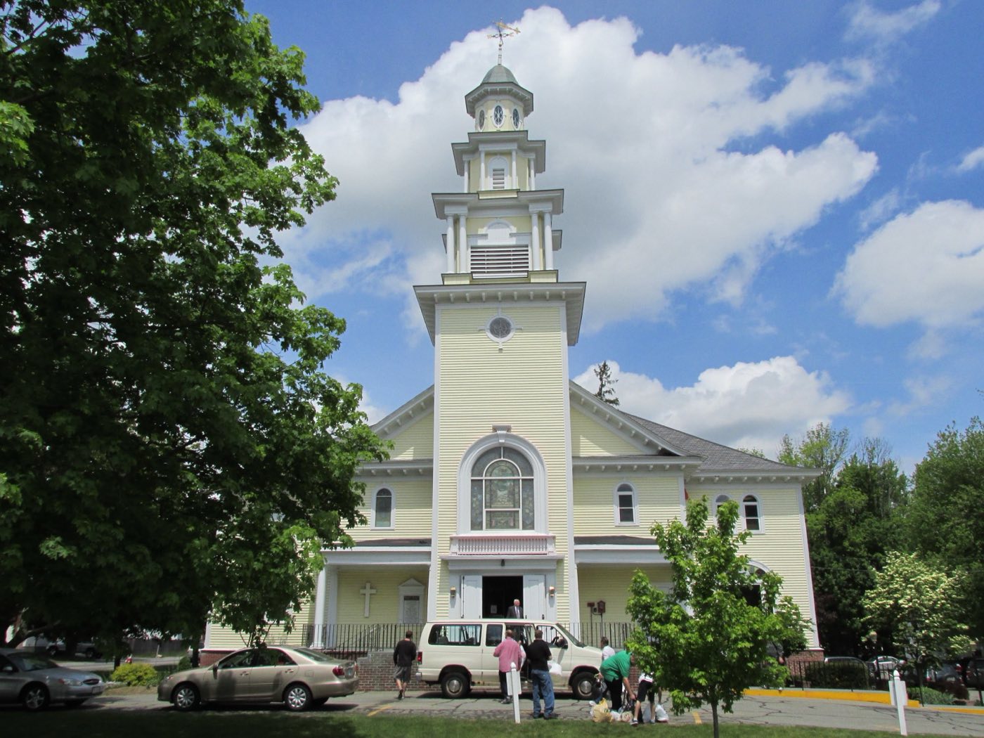
Dracut is a town in Middlesex County in the Merrimack Valley, about 30 miles northwest of Boston and adjoining Lowell. It separated from Chelmsford and was incorporated as its own town on February 26, 1701, after residents petitioned for township status over concerns about distance to services. The Merrimack River forms Dracut's southern border, with Tewksbury and Andover across the river and no direct bridge connection to either.
Dracut uses ZIP code 01826.
| Area | Zip code | Where it is |
|---|---|---|
| Dracut center | 01826 | The area around Town Hall on Arlington Street, one of the town's nine designated business districts. |
Start with Christ Church United (Old Yellow Meeting House) and Lowell-Dracut-Tyngsborough State Forest.
A historic meeting house at the intersection of Route 38 and Route 113, a longstanding landmark in Dracut.
Route 38 & Route 113, Dracut, MA
A state forest spanning Dracut and neighboring Lowell and Tyngsborough, used for hiking and other outdoor recreation.
Dracut, MA
Before English settlement, the area was known as Augumtoocooke and included Pennacook settlements near Pawtucket Falls on the Merrimack River.
In October 1665, Bess, wife of Nobb How and daughter of the Pennacook leader Passaconaway, sold the Augumtoocooke land to Captain John Evered in exchange for four yards of duffill and one pound of tobacco.
Dracut separated from Chelmsford and was incorporated as its own town on February 26, 1701, after residents petitioned for township status.
Dracut's outdoor recreation centers on the Merrimack River, which forms its southern border, and the Lowell-Dracut-Tyngsborough State Forest.
Dracut's nine designated business districts, including Bridge Street, Broadway, Collinsville and Navy Yard, each have a small walkable cluster of stores, but the town overall, without a single dense downtown, is built around driving.
62 Arlington St, Dracut, MA 01826
Approximate, without traffic.
The LRTA 10 bus connects Dracut to the MBTA Commuter Rail Lowell Line station in Lowell. Dracut has no train station of its own; Interstate 93, Interstate 495, U.S. Route 3, and Massachusetts Routes 38, 110 and 113 serve the town.
Dracut's FY2026 residential tax rate is $9.67 per $1,000 of assessed value. Massachusetts assesses homes at full value, so each $100,000 of assessed value costs about $967 a year. The average single-family tax bill was $5,737, on an average assessed value of $593,296.
$9.67per $1,000, residential
Source: Massachusetts Division of Local Services, Tax Rates by Class and Average Single Family Tax Bill.
| Fiscal year | Residential rate |
|---|---|
| FY2022 | $12.29 |
| FY2023 | $11.58 |
| FY2024 | $10.45 |
| FY2025 | $10.12 |
| FY2026 | $9.67 |
What we check on a Dracut purchase: MassHousing limits, the flood map, the smoke certificate, smoke & co certificate.
MassHousing sets its own income and price limits for Middlesex County. We check them with you before you shop.
MassHousing home loansThe Merrimack River forms Dracut's southern border and Beaver Brook bisects the town, putting nearby low-lying parcels in FEMA-mapped flood zones. We check FEMA's map before you offer.
FEMA's flood map for DracutMassachusetts requires the seller to get a smoke and carbon monoxide certificate from the Dracut Fire Department before the sale closes. Call 978-454-1526 to schedule.
Dracut Fire Department pageSellers in Massachusetts need a smoke detector and carbon monoxide alarm compliance certificate from the local fire department before a home sale can close. Dracut's Fire Department can be reached to schedule the required inspection.
All loans are subject to credit approval, underwriting, and property and program requirements. MassHousing limits and eligibility are set by MassHousing and change from time to time.

We're licensed in Massachusetts. Send us a Dracut address and we'll run the numbers, taxes included.
Who to call in Dracut: National Grid, with a Dracut Community Electricity Aggregation (CEA) program for supply while National Grid continues to deliver power and handle billing for power.
Dracut Town Hall is at 62 Arlington St, Dracut, MA 01826.
Dracut's FY2026 residential tax rate is $9.67 per $1,000 of assessed value. Massachusetts fiscal years run July 1 to June 30.
Massachusetts taxes homes on their full assessed value. If a home is assessed at $400,000, that's about $3,868 a year at $9.67 per $1,000. The bill uses the assessor's value, not the sale price.
No. Dracut uses a single rate of $9.67 per $1,000 for all property classes.
The average single-family tax bill in Dracut was $5,737 for FY2026, on an average assessed value of $593,296.
Dracut provides curbside collection with town-issued blue trash carts and green recycling carts as part of its participation in the Recycle Smart MA program.
National Grid delivers electricity in Dracut, and the town also runs a Dracut Community Electricity Aggregation program for supply.
Dracut uses ZIP code 01826.
The LRTA 10 bus connects Dracut to the MBTA Commuter Rail Lowell Line station in Lowell. Dracut has no train station of its own.
Dracut is about 30 miles northwest of Boston and adjoins Lowell.
Neighbors of Dracut, including across the Connecticut line where it applies. All Massachusetts town guides.