

First-time buyer programs in Roxbury
CHFA sets Roxbury's income and price limits for Litchfield County. We check them with you before you shop.
See CHFA's limits map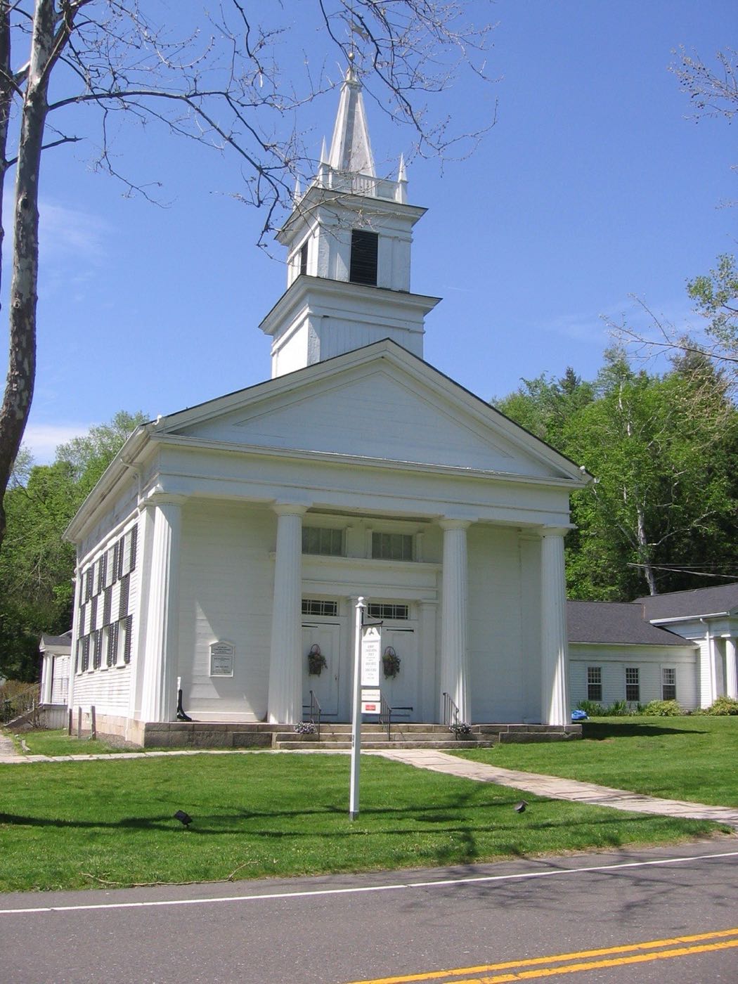
Roxbury is a Litchfield County town in the Northwest Hills, incorporated in October 1796. Its native name was Shepaug, a Mahican word meaning "rocky water," and the Shepaug River still runs through town. Granite quarried from Mine Hill was used in major structures, and the Mine Hill iron-making complex is now a preserved historic site.
Roxbury has 3 villages or sections. Whatever the mailing address says, they're all part of the Town of Roxbury for property taxes and town services.
| Area | Zip code | Where it is |
|---|---|---|
| Roxbury Center | 06783 | The historic town center, home to a locally designated historic district of 32 buildings and the town hall. |
| Judd's Bridge | 06783 | A rural section of town. |
| Roxbury Station | 06783 | A historic district added to the National Register in 2009. |
Roxbury covers about 26.4 square miles and borders Washington, Woodbury and New Milford. It was incorporated in 1796.
Start with Mine Hill Preserve and Minor Memorial Library.
A Roxbury Land Trust preserve built around the ruins of a 19th-century iron-making complex, recognized as a National Historic Place. A roughly 3-mile, moderately difficult trail loops past the furnace ruins.
6 Mine Hill Rd, Roxbury, CT 06783
Plan a visitRoxbury's public library.
Roxbury, CT
Roxbury was incorporated in October 1796; its native name, Shepaug, is a Mahican word meaning "rocky water."
Granite quarried at Mine Hill was used in major structures, and the Mine Hill iron-making complex is now preserved as a National Historic Place.
Roxbury Center's historic district includes 32 buildings, and the Roxbury Station Historic District was added to the National Register of Historic Places in 2009.
The Shepaug River runs through Roxbury, and the Mine Hill Preserve combines hiking trails with the ruins of a 19th-century iron industry site.
Roxbury Center has a small cluster of civic buildings, but the town overall is rural and low-density, so a car is needed for daily errands.
Approximate, without traffic.
There is no fixed-route public transit in Roxbury; the nearest rail service is Metro-North's Danbury Branch or the New Haven Line in the greater Danbury/New Milford area.
Roxbury's 2026–27 mill rate is 13.00, which is $13.00 of tax for every $1,000 of assessed value. Connecticut taxes a home at 70% of its appraised value, so every $100,000 of value costs about $910 a year in taxes at 13.00 mills.
| 12 months ending | Single-family | Condo |
|---|---|---|
| Sep 2024 | $1,250,00017 sales | – |
| Sep 2025 | $1,378,00043 sales | – |
October to September, state records. Text us for this month's sales.
13.00mills, fiscal year 2026–27
| Fiscal year | Town rate |
|---|---|
| 2022–23 | 15.25 |
| 2023–24 | 12.60 |
| 2024–25 | 12.60 |
| 2025–26 | 13.00 |
| 2026–27 | 13.00 |
Roxbury's town rate went from 15.25 in 2022–23 to 13.00 in 2026–27. Next revaluation: October 1, 2027.
What we check on a Roxbury purchase: CHFA limits, the flood map, wells & septic and historic districts.
CHFA sets Roxbury's income and price limits for Litchfield County. We check them with you before you shop.
See CHFA's limits mapThe Shepaug River runs through Roxbury, and low-lying land along it can fall within FEMA-mapped flood zones. We check FEMA's map before you offer.
FEMA's flood map for RoxburyRoxbury is a low-density, rural town where most properties rely on private wells and septic systems rather than public water and sewer, which affects inspection timelines.
Roxbury Center and Roxbury Station have designated historic districts; exterior changes to properties in these areas can be subject to additional local review.
All loans are subject to credit approval, underwriting, and property and program requirements. CHFA and USDA limits and eligibility are set by those agencies and change from time to time.

Send us a Roxbury address and we'll run the numbers, taxes included.
Who to call in Roxbury: Eversource for power.
Roxbury Town Hall is at 29 North St, Roxbury, CT 06783. Each link opens that office's page on the town's website.
The short answers. Call or text us for the long ones.
Roxbury's 2026–27 mill rate is 13.00, which is $13.00 of tax for every $1,000 of assessed value. The motor vehicle rate is 13.00 mills.
Connecticut assesses homes at 70% of appraised value, so a $500,000 home would be assessed at about $350,000. At 13.00 mills that's about $4,550 a year, or about $379 a month. The actual bill depends on the town assessor's appraisal, not the price you pay.
In the 12 months from October 2024 through September 2025, the median single-family sale in Roxbury was $1,378,000 across 43 sales, compared with $1,250,000 the year before.
Roxbury's next revaluation takes effect October 1, 2027, on the state's schedule. The new assessments first show up on the tax bills due in July 2028.
Roxbury is in Litchfield County, in the Northwest Hills.
Roxbury uses ZIP code 06783.
Danbury is about 16 miles from Roxbury, roughly 25–30 minutes by car.
Roxbury has no fixed-route public transit; the nearest rail connections are in the greater Danbury/New Milford area.
Roxbury is part of Regional School District 12, which operates Booth Free School and Shepaug Valley School.
Neighbors of Roxbury in Litchfield County and nearby. All Litchfield County towns.