

Kent center
41 Kent Green Blvd, Kent, CT 06757
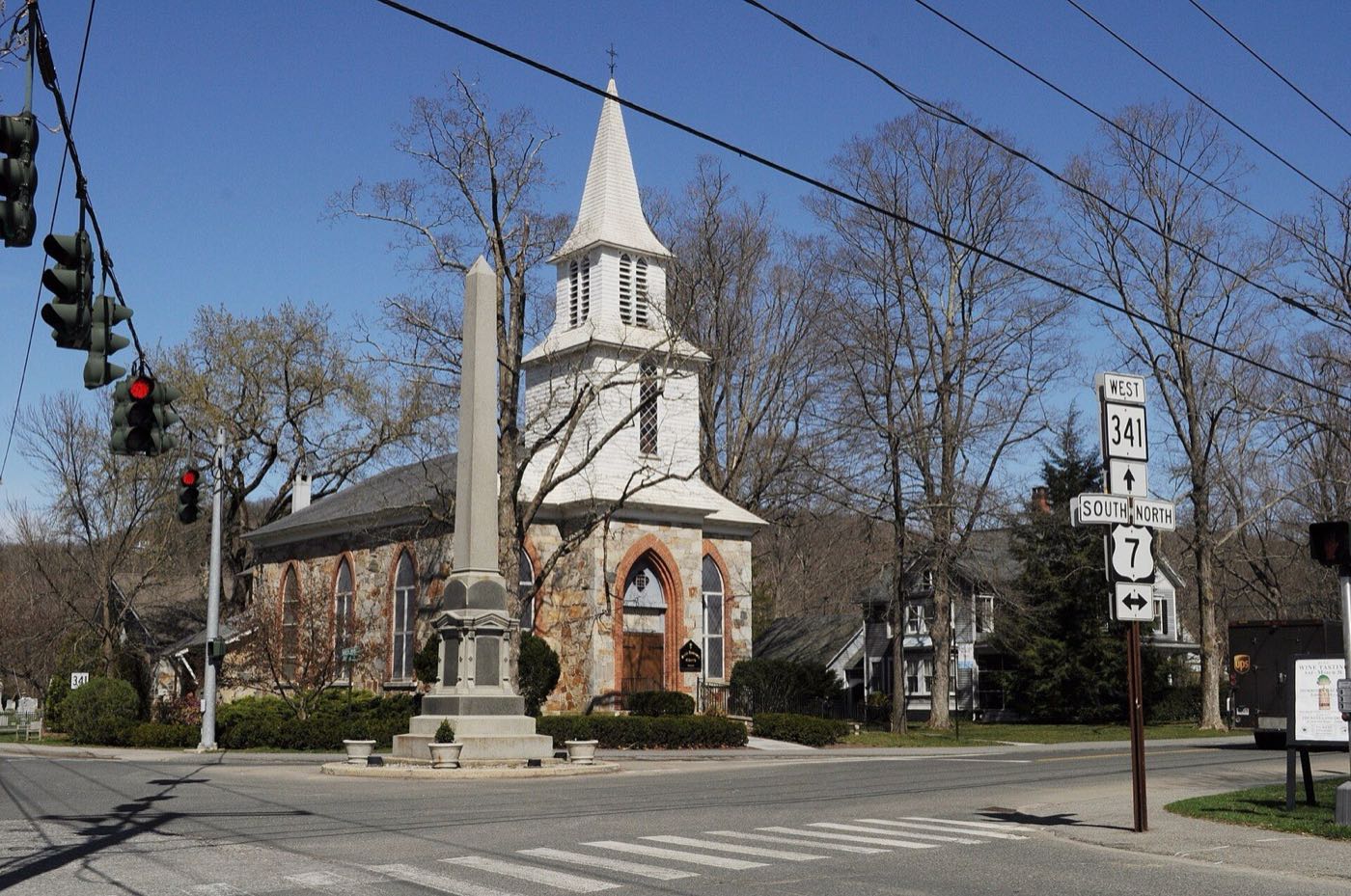
Kent is a Litchfield County town on the New York border, bisected by the Housatonic River. It was settled around 1739 and named for the English county of Kent, and today it includes the villages of Kent center, Bulls Bridge, Flanders and South Kent.
Kent uses ZIP code 06757; South Kent has its own ZIP, 06785.
| Area | Zip code | Where it is |
|---|---|---|
| Kent center | 06757 | The town's main village along US Route 7, with the former train station, shops and Town Hall nearby. |
| South Kent | 06785 | A rural village in the southern part of town, home to South Kent School. |
| Bulls Bridge | 06757 | A village on the Housatonic River known for its 1842 covered bridge, one of two in Connecticut still open to vehicle traffic. |
Kent covers about 48.5 square miles and borders Sharon, Warren, New Milford and Dutchess County, New York. It was incorporated in 1739.
Start with Kent Falls State Park and Bulls Bridge, then 1 more below.
A state park centered on a cascade that drops roughly 70 feet over a series of falls toward the Housatonic River. A 0.84-mile stone-stair trail climbs alongside the falls, and a red-blazed alternate route avoids the stairs.
462 Kent Cornwall Rd, Kent, CT 06757
Plan a visitA wooden lattice-truss covered bridge over the Housatonic River, built in 1842 and one of only two covered bridges in Connecticut still open to vehicle traffic.
Bulls Bridge Rd, Kent, CT
A state park in the western part of town with hiking trails and views along the Macedonia Brook valley, near the Appalachian Trail.
159 Macedonia Brook Rd, Kent, CT 06757
Plan a visitKent was sectioned in 1737 and settled about 1739, and was named for the county of Kent in England.
George Washington crossed the Housatonic River near the site of the present bridge in Kent in 1781.
The Schaghticoke Indian Reservation, one of Connecticut's state-recognized tribal lands, lies within Kent's borders along the Housatonic River.
Kent's outdoor life is built around the Housatonic River valley, with a state-park waterfall, a covered bridge, and a stretch of the Appalachian Trail running through the western hills.
Kent center has a small walkable village along US Route 7 with shops and a former train station, but most of the town is rural and requires a car.
41 Kent Green Blvd, Kent, CT 06757
Approximate, without traffic.
Kent has no fixed-route local bus service. The former Kent train station closed to passengers in 1974; the nearest Metro-North Harlem Line passenger stations are Dover Plains and Harlem Valley–Wingdale in New York.
Kent's 2026–27 mill rate is 17.34, which is $17.34 of tax for every $1,000 of assessed value. Connecticut taxes a home at 70% of its appraised value, so every $100,000 of value costs about $1,214 a year in taxes at 17.34 mills.
| 12 months ending | Single-family | Condo |
|---|---|---|
| Sep 2025 | $484,00026 sales | $387,5006 sales |
October to September, state records. Text us for this month's sales.
17.34mills, fiscal year 2026–27
| Fiscal year | Town rate |
|---|---|
| 2022–23 | 18.57 |
| 2023–24 | 18.76 |
| 2024–25 | 15.59 |
| 2025–26 | 16.87 |
| 2026–27 | 17.34 |
Kent's town rate went from 18.57 in 2022–23 to 17.34 in 2026–27. Next revaluation: October 1, 2028.
What we check on a Kent purchase: CHFA limits, the flood map and river town.
CHFA sets Kent's income and price limits for Litchfield County. We check them with you before you shop.
See CHFA's limits mapKent is bisected by the Housatonic River, and low-lying land along the river, including near Bulls Bridge and Kent Falls, falls within FEMA-mapped flood zones. We check FEMA's map before you offer.
FEMA's flood map for KentKent is split by the Housatonic River, and riverside parcels can fall within FEMA flood zones. We check the flood map before you make an offer on a property near the river.
All loans are subject to credit approval, underwriting, and property and program requirements. CHFA and USDA limits and eligibility are set by those agencies and change from time to time.

Send us a Kent address and we'll run the numbers, taxes included.
Who to call in Kent: Eversource for power.
Kent Town Hall is at 41 Kent Green Blvd, Kent, CT 06757. Hours: Mon–Fri 9:00 a.m.–12:00 p.m. and 12:30–4:00 p.m.. Each link opens that office's page on the town's website.
The short answers. Call or text us for the long ones.
Kent's 2026–27 mill rate is 17.34, which is $17.34 of tax for every $1,000 of assessed value. The motor vehicle rate is 17.34 mills.
Connecticut assesses homes at 70% of appraised value, so a $500,000 home would be assessed at about $350,000. At 17.34 mills that's about $6,069 a year, or about $506 a month. The actual bill depends on the town assessor's appraisal, not the price you pay.
In the 12 months from October 2024 through September 2025, the median single-family sale in Kent was $484,000 across 26 sales. The median condo sale was $387,500 across 6 sales.
Kent's next revaluation takes effect October 1, 2028, on the state's schedule. The new assessments first show up on the tax bills due in July 2029.
Kent is in Litchfield County.
Kent's main ZIP code is 06757; South Kent has its own ZIP, 06785.
Kent is about 26 miles north of Danbury, roughly a 35–40 minute drive.
No. The Kent train station closed to passengers in 1974. The nearest Metro-North Harlem Line stations are Dover Plains and Harlem Valley–Wingdale in New York.
Kent is part of Regional School District 1, along with Canaan, Cornwall, North Canaan, Salisbury and Sharon.
Neighbors of Kent in Litchfield County and nearby. All Litchfield County towns.