

Topsfield center
8 West Common St, Topsfield, MA 01983
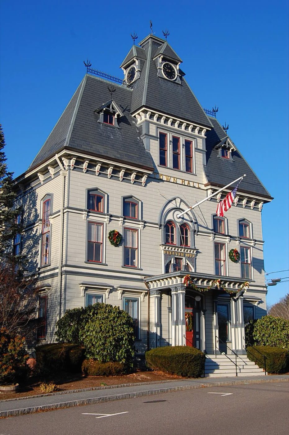
Topsfield sits at the geographic center of Essex County, about 10 miles north of Salem, and was settled in 1635 under the name New Meadows before being renamed for Toppesfield, England, and incorporated in 1650. U.S. Route 1 runs nearly the length of the town from southwest to northeast, and the Ipswich River and 68-acre Hood's Pond are its largest water features. Topsfield is home to the Topsfield Fair, which began in 1818 and is one of the oldest continuously running agricultural fairs in the country.
The entire town uses ZIP code 01983.
| Area | Zip code | Where it is |
|---|---|---|
| Topsfield center | 01983 | The town's single village center, where Town Hall sits on the Town Common. |
Start with Topsfield Fair and Ipswich River Wildlife Sanctuary, then 3 more below.
An agricultural fair that began in 1818 and is one of the oldest continuously running fairs in the country, running 11 days between late September and Columbus Day with livestock shows, carnival rides and the All New England Giant Pumpkin Weigh-Off.
Topsfield Fairgrounds, Topsfield, MA
Plan a visitA Mass Audubon sanctuary with trails through woods, wetlands and river frontage; part of the property lies within Topsfield.
Topsfield/Ipswich, MA
Plan a visitA state park with woodland and river trails, part of which extends into Topsfield.
Topsfield/Ipswich/Hamilton, MA
A First Period house built in 1683, one of the town's oldest surviving structures.
Topsfield, MA
Town-owned woodland with walking trails.
Topsfield, MA
The area was settled by English colonists in 1635 as New Meadows and renamed for Toppesfield, England, when it was incorporated as Topsfield in 1650.
Several Topsfield residents, including Rebecca Nurse, Sarah Cloyce, Mary Esty, Sarah Wildes and Elizabeth Howe, were accused during the 1692 Salem witch trials, and several were executed.
The Topsfield Fair began in 1818 and is one of the oldest continuously operating agricultural fairs in the United States.
Topsfield's outdoor land centers on the Ipswich River and its wetlands, with parts of two large conservation properties, Ipswich River Wildlife Sanctuary and Bradley Palmer State Park, extending into town alongside Hood's Pond and the town forest.
Topsfield's small center around the Town Common has sidewalks connecting Town Hall, the library and nearby homes, but Route 1 and the rest of town are built for driving.
8 West Common St, Topsfield, MA 01983
Approximate, without traffic.
Topsfield has no MBTA Commuter Rail station of its own; the Newburyport/Rockport Line runs through neighboring towns, with stations in Ipswich and Hamilton/Wenham. There is no fixed-route local bus service.
Topsfield's FY2026 residential tax rate is $15.66 per $1,000 of assessed value. Massachusetts assesses homes at full value, so each $100,000 of assessed value costs about $1,566 a year. The average single-family tax bill was $14,483, on an average assessed value of $924,852.
$15.66per $1,000, residential
Source: Massachusetts Division of Local Services, Tax Rates by Class and Average Single Family Tax Bill.
| Fiscal year | Residential rate |
|---|---|
| FY2022 | $16.65 |
| FY2023 | $15.20 |
| FY2024 | $14.69 |
| FY2025 | $14.99 |
| FY2026 | $15.66 |
What we check on a Topsfield purchase: MassHousing limits, the flood map, the smoke certificate, smoke & co certificate, river flood zones.
MassHousing sets its own income and price limits for Essex County. We check them with you before you shop.
MassHousing home loansLand along the Ipswich River and around Hood's Pond falls within FEMA-mapped flood zones. We check FEMA's map before you offer.
FEMA's flood map for TopsfieldMassachusetts requires the seller to get a smoke and carbon monoxide certificate from the Topsfield Fire and Rescue Department before the sale closes. Call 978-887-5148 to schedule.
Topsfield Fire and Rescue Department pageSellers in Massachusetts need a smoke detector and carbon monoxide alarm compliance certificate from the local fire department before a home sale can close. Contact the Topsfield Fire and Rescue Department to schedule the inspection.
Parts of town near the Ipswich River and Hood's Pond are mapped in FEMA flood zones; buyers there should check the flood map and ask about flood insurance.
All loans are subject to credit approval, underwriting, and property and program requirements. MassHousing limits and eligibility are set by MassHousing and change from time to time.

We're licensed in Massachusetts. Send us a Topsfield address and we'll run the numbers, taxes included.
Who to call in Topsfield.
Topsfield Town Hall is at 8 West Common St, Topsfield, MA 01983. Main line: 978-887-1500.
Topsfield's FY2026 residential tax rate is $15.66 per $1,000 of assessed value. Massachusetts fiscal years run July 1 to June 30.
Massachusetts taxes homes on their full assessed value. If a home is assessed at $400,000, that's about $6,264 a year at $15.66 per $1,000. The bill uses the assessor's value, not the sale price.
No. Topsfield uses a single rate of $15.66 per $1,000 for all property classes.
The average single-family tax bill in Topsfield was $14,483 for FY2026, on an average assessed value of $924,852.
The entire town uses ZIP code 01983.
Yes. Topsfield uses automated curbside collection with town-issued trash and recycling carts, hauled by G. Mello Disposal Corp.
No. Topsfield has no Commuter Rail station of its own; the Newburyport/Rockport Line runs through neighboring Ipswich and Hamilton/Wenham.
Topsfield is about 22 miles north of Boston and about 10 miles north of Salem.
An agricultural fair that began in 1818, running 11 days between late September and Columbus Day with livestock, carnival rides and the Giant Pumpkin Weigh-Off.
Neighbors of Topsfield, including across the Connecticut line where it applies. All Massachusetts town guides.