

Rowley center
139 Main Street, Rowley, MA 01969
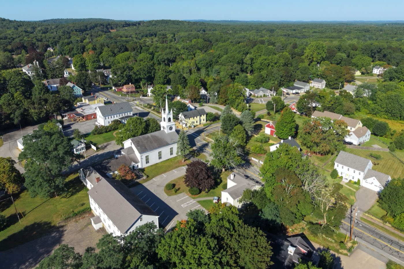
Rowley is a coastal Essex County town settled in 1638 by the Reverend Ezekiel Rogers and about 20 families, and incorporated in 1639. Its eastern side is salt marsh feeding Mud Creek, Mill River and the Rowley River, with part of the Parker River National Wildlife Refuge and Plum Island marshes protected within town, while its west end reaches into wooded upland along Route 1 and I-95.
The entire town uses ZIP code 01969.
| Area | Zip code | Where it is |
|---|---|---|
| Rowley center | 01969 | The town's village center along Main Street, where Town Hall and the MBTA Commuter Rail station sit. |
Start with Agawam Diner and Parker River National Wildlife Refuge marshes, then 2 more below.
A 1954 Fodero Dining Car Company diner listed on the National Register of Historic Places, moved to Rowley from Ipswich in 1970.
166 Newburyport Turnpike (Route 1), Rowley, MA
Salt marsh and barrier-beach habitat that extends into Rowley, part of a federal wildlife refuge based on Plum Island.
Rowley, MA
Plan a visitA house built in 1677 that serves as home to the Rowley Historical Society.
Rowley, MA
A state forest with wooded trails on Rowley's western side.
Rowley, MA
The Reverend Ezekiel Rogers led about 20 families to settle Rowley in 1638; the town was incorporated in 1639 and named for Rowley in the East Riding of Yorkshire, England.
A stone arch bridge built in 1642, said to be the first of its kind in North America, was constructed of hand-chiseled granite laid without mortar.
A sawmill established in Rowley in 1669 continued operating on the same site for centuries.
Rowley's east side is dominated by salt marsh and tidal creeks feeding toward Plum Island and the Parker River National Wildlife Refuge, while its west end has wooded state forest and Bay Circuit Trail access.
1 places in Rowley to try, including diner. No one paid to be listed.
Diner
A 1954 Fodero-built diner on the National Register of Historic Places, serving classic diner fare on Route 1.
166 Newburyport Turnpike, Rowley, MA
Rowley's small Main Street center near Town Hall and the commuter rail station has sidewalks, but the town's marshland and rural roads mean most errands require a car.
139 Main Street, Rowley, MA 01969
Approximate, without traffic.
Rowley has its own MBTA Commuter Rail station on the Newburyport/Rockport Line. Interstate 95 crosses the town's western end, with U.S. Route 1 and Massachusetts Routes 1A and 133 also running through town.
Rowley's FY2026 residential tax rate is $12.09 per $1,000 of assessed value. Massachusetts assesses homes at full value, so each $100,000 of assessed value costs about $1,209 a year. The average single-family tax bill was $9,235, on an average assessed value of $763,866.
$12.09per $1,000, residential
Source: Massachusetts Division of Local Services, Tax Rates by Class and Average Single Family Tax Bill.
| Fiscal year | Residential rate |
|---|---|
| FY2022 | $14.62 |
| FY2023 | $13.02 |
| FY2024 | $12.10 |
| FY2025 | $11.77 |
| FY2026 | $12.09 |
What we check on a Rowley purchase: MassHousing limits, the flood map, the smoke certificate, municipal electric utility, marsh flood zones, septic and wells.
MassHousing sets its own income and price limits for Essex County. We check them with you before you shop.
MassHousing home loansRowley's eastern side is largely salt marsh draining to Mud Creek, Mill River, the Rowley River and the Parker River estuary near Plum Island, and low-lying land there falls within FEMA-mapped flood zones. We check FEMA's map before you offer.
FEMA's flood map for RowleyMassachusetts requires the seller to get a smoke and carbon monoxide certificate from the Rowley Fire Department before the sale closes. Call 978-948-3812 to schedule.
Rowley Fire Department pageElectric service in Rowley is provided by the Rowley Municipal Lighting Plant rather than an investor-owned utility; buyers should set up service directly with the RMLP.
Learn moreRowley's eastern side is salt marsh draining toward Plum Island and the Parker River; buyers there should check the FEMA flood map and ask about flood insurance.
The Rowley Board of Health issues Title 5 septic permits and provides well-water testing guidance for properties not on public sewer.
All loans are subject to credit approval, underwriting, and property and program requirements. MassHousing limits and eligibility are set by MassHousing and change from time to time.

We're licensed in Massachusetts. Send us a Rowley address and we'll run the numbers, taxes included.
Who to call in Rowley: Rowley Municipal Lighting Plant for power.
Rowley Town Hall is at 139 Main Street, Rowley, MA 01969. Main line: 978-948-2081.
Rowley's FY2026 residential tax rate is $12.09 per $1,000 of assessed value. Massachusetts fiscal years run July 1 to June 30.
Massachusetts taxes homes on their full assessed value. If a home is assessed at $400,000, that's about $4,836 a year at $12.09 per $1,000. The bill uses the assessor's value, not the sale price.
No. Rowley uses a single rate of $12.09 per $1,000 for all property classes.
The average single-family tax bill in Rowley was $9,235 for FY2026, on an average assessed value of $763,866.
The entire town uses ZIP code 01969.
The Rowley Municipal Lighting Plant, a town-owned electric utility, rather than an investor-owned company.
Yes. Rowley has its own stop on the MBTA Commuter Rail Newburyport/Rockport Line.
Rowley is about 7 miles south of Newburyport.
The town administers a trash and recycling program; check the town website for current collection details.
Neighbors of Rowley, including across the Connecticut line where it applies. All Massachusetts town guides.