

First-time buyer programs
MassHousing sets its own income and price limits for Essex County. We check them with you before you shop.
MassHousing home loans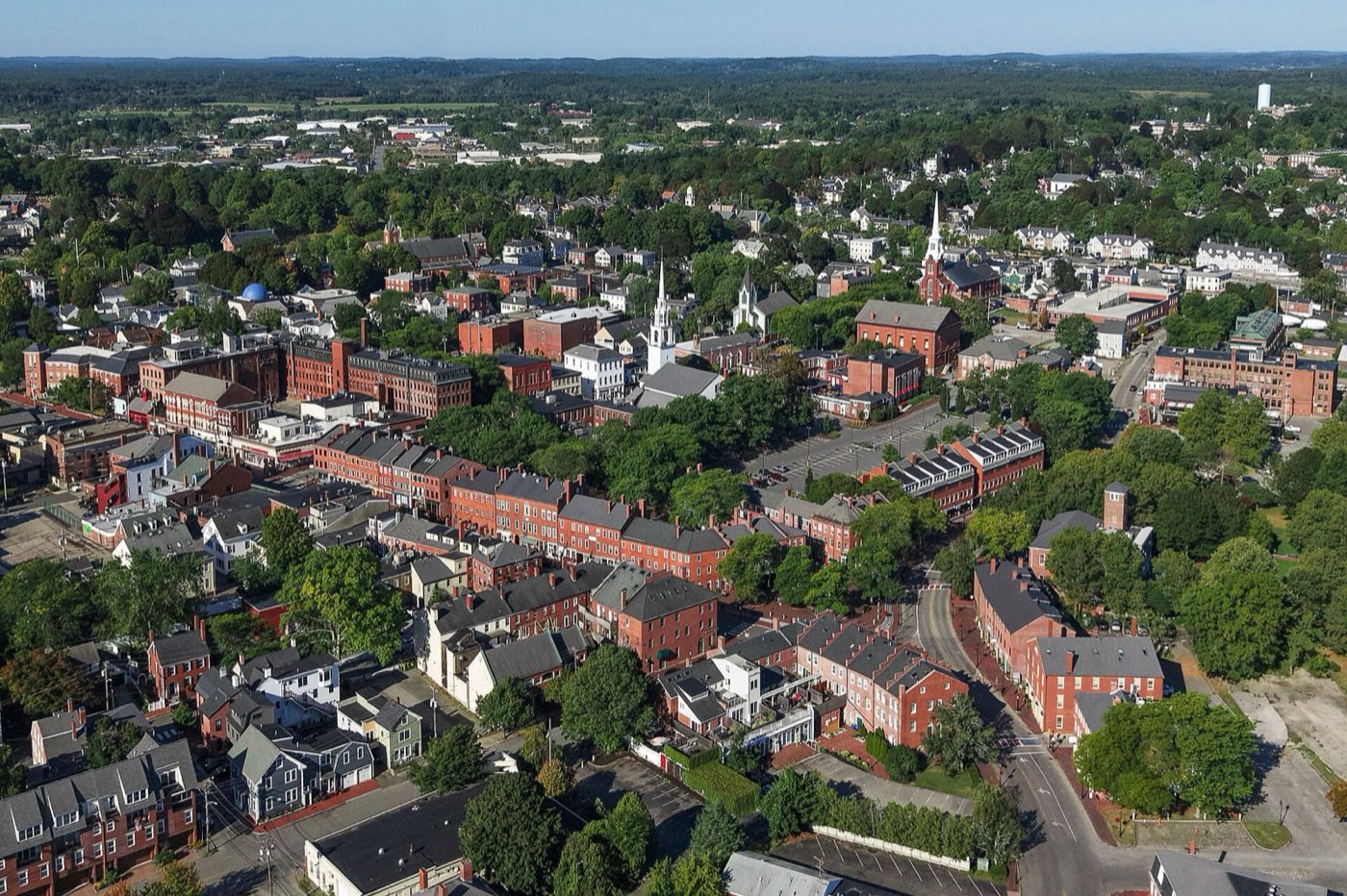
Newburyport is a small city on the south bank of the Merrimack River where it meets the Atlantic, bordered by Newbury, West Newbury, Amesbury and Salisbury. It separated from Newbury and was incorporated as its own town in 1764, becoming a city in 1851. A shipbuilding and whaling port in the 18th and 19th centuries, its downtown of brick commercial blocks and federal-style houses was preserved rather than demolished during a 1970s urban renewal push.
Newburyport uses ZIP code 01950 citywide.
| Area | Zip code | Where it is |
|---|---|---|
| Downtown | 01950 | The brick commercial district around Market Square and State Street, along the Merrimack River waterfront. |
| South End | 01950 | A residential neighborhood south of downtown. |
| Joppa | 01950 | A historic waterfront neighborhood along the Merrimack, once home to fishing families. |
| Plum Island | 01950 | A barrier island section of the city on the Atlantic, shared with the Parker River National Wildlife Refuge. |
Start with Market Square Historic District and Cushing House Museum & Garden, then 2 more below.
The city's downtown core of federal- and Victorian-era brick commercial buildings, now filled with shops and restaurants near the waterfront.
Market Square, Newburyport, MA
A federal-period house museum maintained by the Historical Society of Old Newbury, with period rooms and a garden.
Newburyport, MA
A state park along the Merrimack River with woodland trails, former estate gardens, and river views.
Newburyport, MA
A federal wildlife refuge covering most of Plum Island, with beach access, dunes and birdwatching trails.
Plum Island, Newburyport, MA
Newburyport separated from Newbury and was incorporated as its own town in 1764, with about 2,800 residents in 357 homes at the time; it became a city in 1851.
The city was a major shipbuilding and whaling port through the 18th and 19th centuries, built on the Merrimack River's deep water access to the Atlantic.
A 1970s urban renewal plan proposed demolishing much of downtown; preservation efforts instead restored its brick commercial blocks, which now anchor the historic district.
The Merrimack River waterfront, Plum Island's beaches and refuge, and Maudslay State Park give Newburyport a range of outdoor options from urban riverfront to barrier-island dunes.
Downtown Newburyport, with Market Square and State Street, is compact and walkable with shops and restaurants close together, but Plum Island and the outlying residential neighborhoods require a car.
Approximate, without traffic.
The MBTA Newburyport/Rockport commuter rail line terminates in Newburyport, with direct service to Boston's North Station.
Newburyport's FY2026 residential tax rate is $9.26 per $1,000 of assessed value. Massachusetts assesses homes at full value, so each $100,000 of assessed value costs about $926 a year. The average single-family tax bill was $10,249, on an average assessed value of $1,106,755.
$9.26per $1,000, residential
Source: Massachusetts Division of Local Services, Tax Rates by Class and Average Single Family Tax Bill.
| Fiscal year | Residential rate |
|---|---|
| FY2022 | $12.01 |
| FY2023 | $10.74 |
| FY2024 | $9.97 |
| FY2025 | $9.58 |
| FY2026 | $9.26 |
What we check on a Newburyport purchase: MassHousing limits, the flood map, the smoke certificate, coastal flood zone.
MassHousing sets its own income and price limits for Essex County. We check them with you before you shop.
MassHousing home loansNewburyport's Merrimack River waterfront and Plum Island barrier-beach areas fall within FEMA-mapped coastal flood zones. We check FEMA's map before you offer.
FEMA's flood map for NewburyportMassachusetts requires the seller to get a smoke and carbon monoxide certificate from the Newburyport Fire Department before the sale closes. Call 978-465-4427 to schedule.
Newburyport Fire Department pageLow-lying waterfront parcels along the Merrimack River and on Plum Island fall within FEMA-mapped flood zones. We check the flood map before you make an offer near the water.
All loans are subject to credit approval, underwriting, and property and program requirements. MassHousing limits and eligibility are set by MassHousing and change from time to time.

We're licensed in Massachusetts. Send us a Newburyport address and we'll run the numbers, taxes included.
Who to call in Newburyport: National Grid delivers electricity; the city also runs a Community Choice Power Supply Program for electricity supply for power.
Newburyport City Hall is at 60 Pleasant St, Newburyport, MA 01950. Main line: 978-465-4413.
Newburyport's FY2026 residential tax rate is $9.26 per $1,000 of assessed value. Massachusetts fiscal years run July 1 to June 30.
Massachusetts taxes homes on their full assessed value. If a home is assessed at $400,000, that's about $3,704 a year at $9.26 per $1,000. The bill uses the assessor's value, not the sale price.
No. Newburyport uses a single rate of $9.26 per $1,000 for all property classes.
The average single-family tax bill in Newburyport was $10,249 for FY2026, on an average assessed value of $1,106,755.
Newburyport is in Essex County.
Newburyport uses ZIP code 01950 citywide.
Yes. The MBTA Newburyport/Rockport commuter rail line terminates in Newburyport with direct service to Boston's North Station.
National Grid delivers electricity; the city also runs its own Community Choice Power Supply Program for electricity supply.
Yes. The city contracts with G. Mello Disposal Corp. for curbside trash and recycling.
Newburyport is about 35 miles from Boston, roughly a 45-60 minute drive.
Neighbors of Newburyport, including across the Connecticut line where it applies. All Massachusetts town guides.