

First-time buyer programs
MassHousing sets its own income and price limits for Berkshire County. We check them with you before you shop.
MassHousing home loans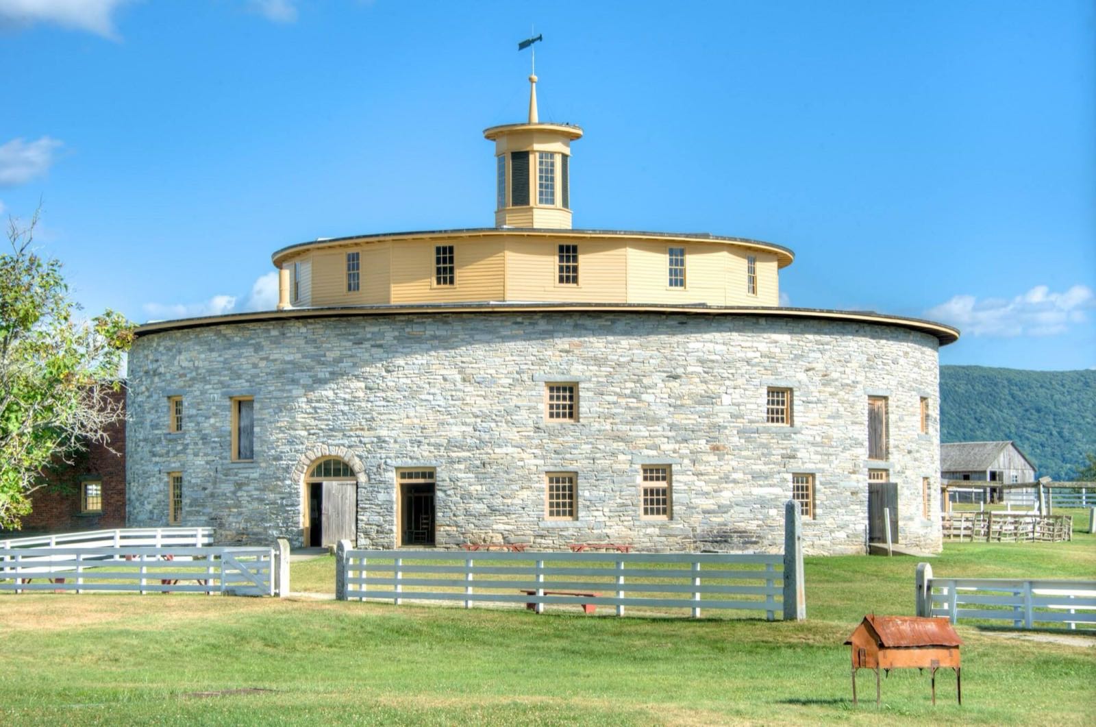
Hancock is a town in Berkshire County on the New York border, described on its own town website as the longest and narrowest town in the county, about twenty miles long and three miles wide. It sits in a valley between the Taconic Mountains, first settled in 1767 and incorporated in 1776. The Shaker community that founded Hancock Shaker Village dates to about 1790.
Hancock uses ZIP codes shared with neighboring post offices: 01237 (Lanesborough), 01267 (Williamstown) and 01201 (Pittsfield), depending on location in town.
| Area | Zip code | Where it is |
|---|---|---|
| Hancock center | 01237 | Along Hancock Road (Route 43), where Town Hall is located. |
Start with Hancock Shaker Village and Jiminy Peak, then 2 more below.
A former Shaker religious community, established by about 1790, preserved as a museum with historic buildings including the Round Stone Barn built in 1826. It straddles the Hancock-Pittsfield line.
Hancock, MA
A ski and mountain resort whose terrain extends into Hancock, with alpine skiing in winter and mountain-based activities in summer.
Hancock, MA
A farm listed by the town among local businesses, known regionally for maple sugaring and pick-your-own produce.
Hancock, MA
A state forest reaching into the southern part of Hancock, with hiking and multi-use trails through the Taconic range.
Hancock/Pittsfield, MA
Hancock was first settled in 1762 as the Plantation of Jericho and officially incorporated as Hancock, named for John Hancock, in 1776.
A Shaker religious community was established in Hancock by about 1790, whose village and Round Stone Barn, built in 1826, survive as Hancock Shaker Village.
Hancock is one of only three Massachusetts towns that historically was not served by the Bell System, instead using the independent Taconic Telephone Corporation.
Hancock lies in a valley between two ranges of the Taconic Mountains, with Pittsfield State Forest and Jiminy Peak's slopes reaching into town alongside the west branch of the Green River and Berry Pond.
1 places in Hancock to try, including restaurant. No one paid to be listed.
Restaurant
A food business listed among Hancock's local businesses on the town website.
Hancock, MA
Hancock has no sidewalked town center; it is a rural, twenty-mile-long valley town along Route 43 built for driving between its scattered village, farm and resort areas.
Approximate, without traffic.
Hancock has no fixed-route public transit, bus service or train station. The nearest airport is Albany International, about 40 miles northwest.
Hancock's FY2026 residential tax rate is $2.18 per $1,000 of assessed value. Massachusetts assesses homes at full value, so each $100,000 of assessed value costs about $218 a year. The average single-family tax bill was $835, on an average assessed value of $383,147.
$2.18per $1,000, residential
Source: Massachusetts Division of Local Services, Tax Rates by Class and Average Single Family Tax Bill.
| Fiscal year | Residential rate |
|---|---|
| FY2022 | $3.00 |
| FY2023 | $2.68 |
| FY2024 | $2.79 |
| FY2025 | $2.69 |
| FY2026 | $2.18 |
What we check on a Hancock purchase: MassHousing limits, the flood map, the smoke certificate, well & septic, long, narrow town.
MassHousing sets its own income and price limits for Berkshire County. We check them with you before you shop.
MassHousing home loansThe west branch of the Green River and Kinderhook Creek drain Hancock's valley; low-lying land near these streams can fall within FEMA-mapped flood zones. We check FEMA's map before you offer.
FEMA's flood map for HancockMassachusetts requires the seller to get a smoke and carbon monoxide certificate from the Hancock Fire Department before the sale closes. Call 413-738-5225 to schedule.
Hancock Fire Department pageHancock has no townwide public water or sewer system; most properties use private wells and septic systems. Buyers should confirm well and septic condition, including a Title 5 inspection, before closing.
Because Hancock is about twenty miles long and three miles wide, a property's ZIP code (Lanesborough, Williamstown or Pittsfield) and drive time to services depend heavily on where in town it sits.
All loans are subject to credit approval, underwriting, and property and program requirements. MassHousing limits and eligibility are set by MassHousing and change from time to time.

We're licensed in Massachusetts. Send us a Hancock address and we'll run the numbers, taxes included.
Who to call in Hancock.
Hancock Town Hall is at 3650 Hancock Road, PO Box 1084, Hancock, MA 01237. Hours: Weekdays (except holidays), 9:00 AM-12:00 noon. Main line: 413-738-5225.
Hancock's FY2026 residential tax rate is $2.18 per $1,000 of assessed value. Massachusetts fiscal years run July 1 to June 30.
Massachusetts taxes homes on their full assessed value. If a home is assessed at $400,000, that's about $872 a year at $2.18 per $1,000. The bill uses the assessor's value, not the sale price.
No. Hancock uses a single rate of $2.18 per $1,000 for all property classes.
The average single-family tax bill in Hancock was $835 for FY2026, on an average assessed value of $383,147.
Hancock is in Berkshire County.
Hancock uses 01237 (Lanesborough), 01267 (Williamstown) or 01201 (Pittsfield) depending on location in town.
No. Hancock has no fixed-route bus service or train station.
Hancock borders Williamstown, New Ashford, Lanesborough, Pittsfield and Richmond in Massachusetts, and Canaan, New Lebanon, Stephentown and Berlin in New York.
Town Hall, at 3650 Hancock Road, is open weekdays (except holidays) from 9:00 AM to 12:00 noon.
The town lists a Transfer Station among its departments; current hours and permit pricing were not published on the town website at the time of research.
Neighbors of Hancock, including across the Connecticut line where it applies. All Massachusetts town guides.